


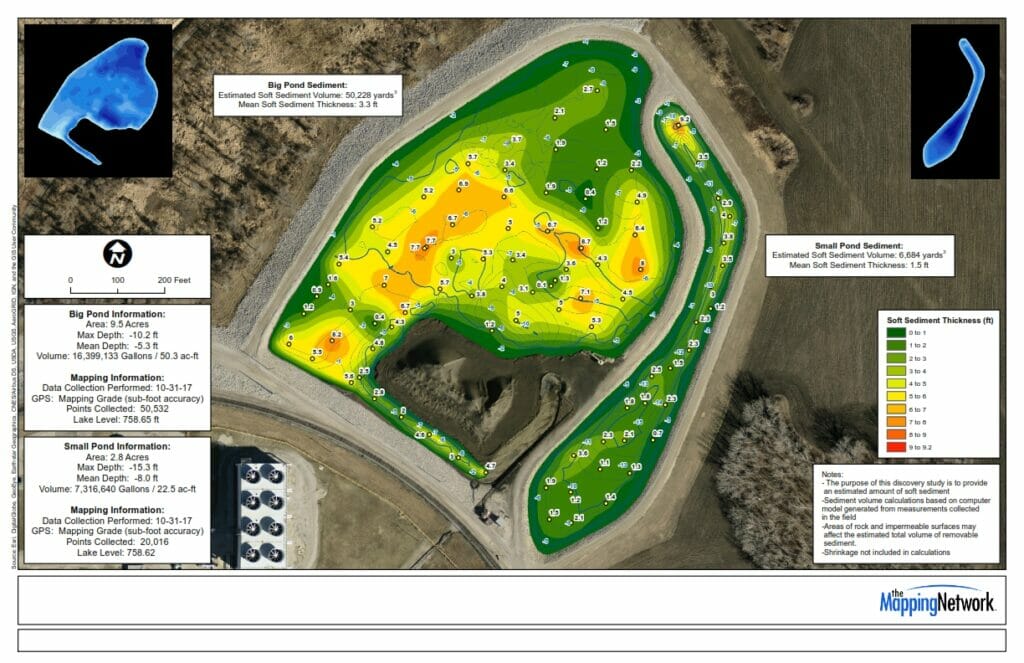
HOA’s approach us and ask great questions. Below is a retention basin. Basins are designed to fill with water during storms and discharge the water effectively. Debris and sediment often accumulate overtime causing problems. This image shows sediment thickness found by sediment probes & sonar technology. It’s vital to know how much sediment and other material accumulates in retention basins to insure that it is functioning properly.
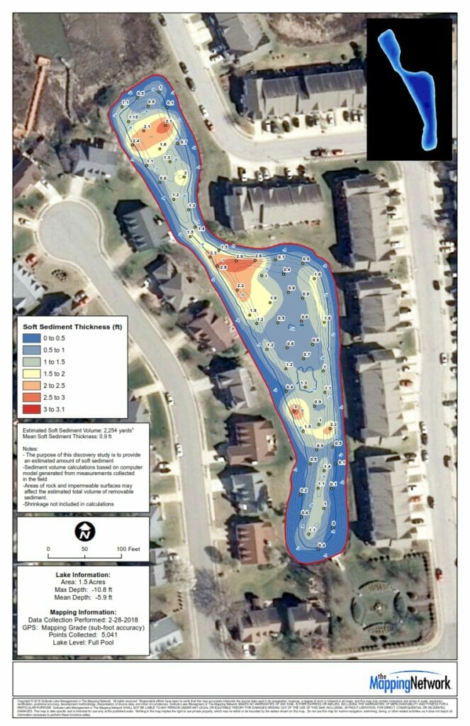
A hydrographic and sediment study was recently conducted on a retention pond to provide a information to help with proper management. It’s important to know how much sediment and other material accumulates in retention basins to insure that it’s functioning properly. The image below shows the sediment thickness found by the sediment probes and sonar technology.
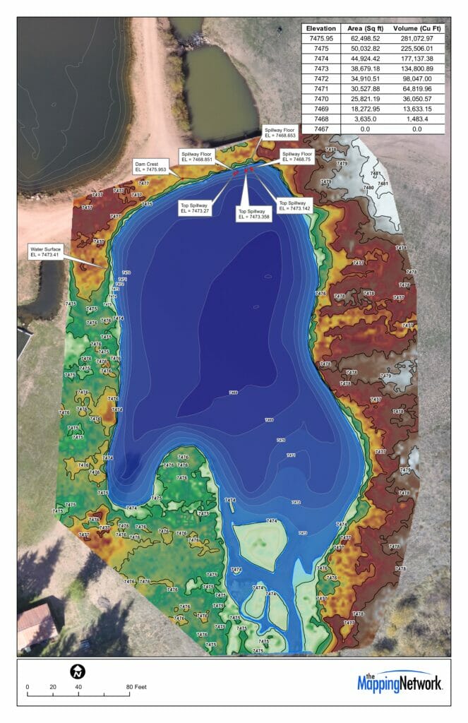
The Mapping Network conducted a hydrographic and topography survey for several trout ponds. They utilized Odom Sonar, Trimble RTK GPS, and Hypack to create the bathymetry. For the topography they used Trimble RTK GPS for control and a UAV / Drone to collect the images that produced the orthographic image and topography contours. All data was then input into ArcGIS for final processing.
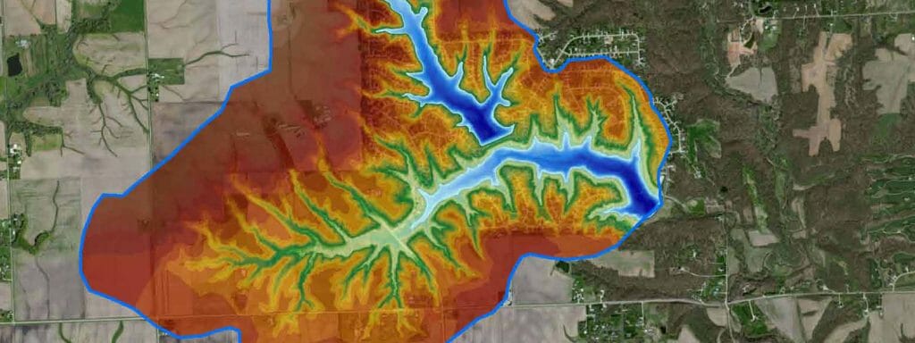
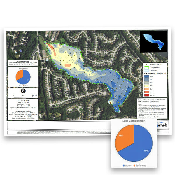
The Mapping Network just completed a lake survey for a property owner association. The lake has experienced significant sediment in the coves and main river inlet over the years. The Mapping Network sampled the sediment structure and mapped the sludge thickness to help the client in the dredging bid process. Part of the report included understanding sources of sediment and how activity within the watershed will ultimately affect the lake. Below is a map showing…
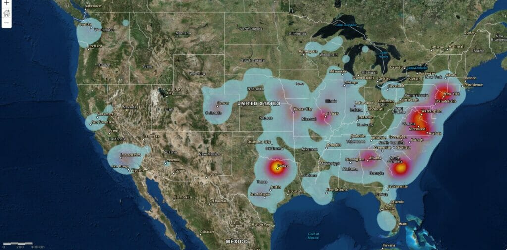
Below is a heat map that show the locations of all our projects over the past few years. These projects range from bathymetry, sediment studies for dredging projects, pre and post dredge surveys, water capacity studies, uav/drone land mapping and imagery, and 3d modeling.
The Mapping Network performed a hydrographic and dredge survey for a power plant’s coal ash ponds. These can be difficult because of the composition of material. With the combination our sonar, GPS, and years of experience with coal ash, we were able to give them an accurate estimate of ash volume.
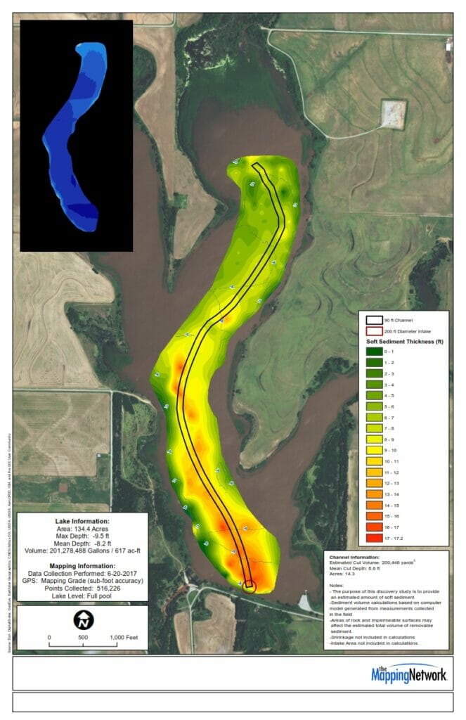
The Mapping Network performed a pre-dredge and sediment study on a county reservoir. Their mission was to locate a historic channel buried under several feet of soft sediment. The Mapping Network had to carefully examine the sonar readings and sediment probe information to best locate the channel. The result of the analaysis providing accurate information to plot the idea course for the dredger to input into their Dredgepak software system.
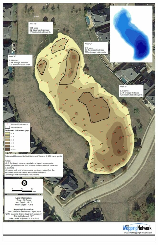
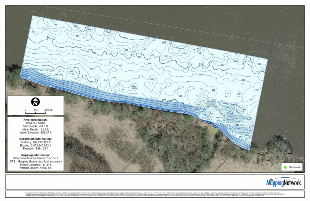
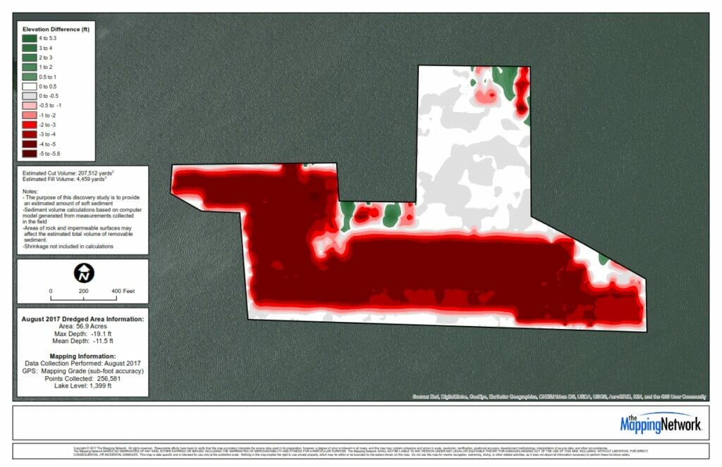
The Mapping Network previously conducted a hydrographic survey to analyze the amount of sediment in a lake. After determining cost of sediment removal, the lake owner decided to dredge specific locations of sediment. The Mapping Network was able to perform volume calculations on the precise boundaries without any additional surveying.
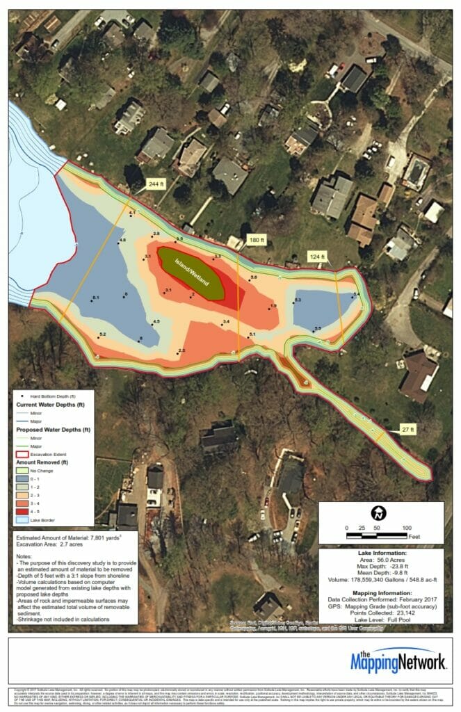
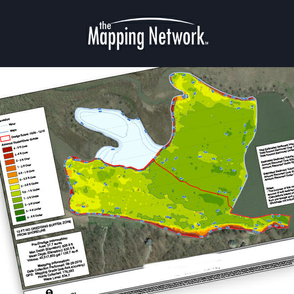
The Mapping Network performed a dredging excavation analysis for a lake association on multiple coves with sediment issues. The Mapping Network first conducted a pre-dredge survey along with sediment probes of the coves. With this data, they were able to create models estimating the volume of material needed to excavate to a specific water depth.

Accurate. Professional. Complete. Trusted for over 20 years.