Sediment Distrubution

The Mapping Network surveyed the bottom of the lake including the sediment depths. This map shows the lake water depth as blue contours lines as well as a color shaded sediment thickness. This specialized technology allows the POA to easily locate problem areas.

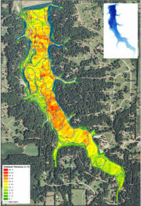
The Mapping Network surveyed the bottom of the lake including the sediment depths. This map shows the lake water depth as blue contours lines as well as a color shaded sediment thickness. This specialized technology allows the POA to easily locate problem areas.

Leave a Reply

Your email address will not be published. Required fields are marked *

*