Budget Time for Hydrographic and Sediment Surveys
It’s Budget Season!
Don’t Forget About the Pond!
By SOLitude Lake Management www.solitudelakemanagement.com
*Do you know if dredging is in your future?
*Do you know how much time you have before your dredging project will begin?
*Do you have a plan in place to deal with the cost and the logistics of such a large project?
Important Things to Remember When Preparing Your 2013 Budget
- Annual Pond Maintenance to make certain that your pond is receiving care year round.
- Adding Aeration (fountain or aerator) if your pond does not currently have a functioning aeration system.
- Adding Annual Aeration (fountain or aerator) maintenance. Even if these items are under warranty, maintenance is still needed. (Think of the care you give your car motor.)
- Funds to enhance your maintenance program with fish stocking, mosquito control, holiday lighting, or other services as desired.
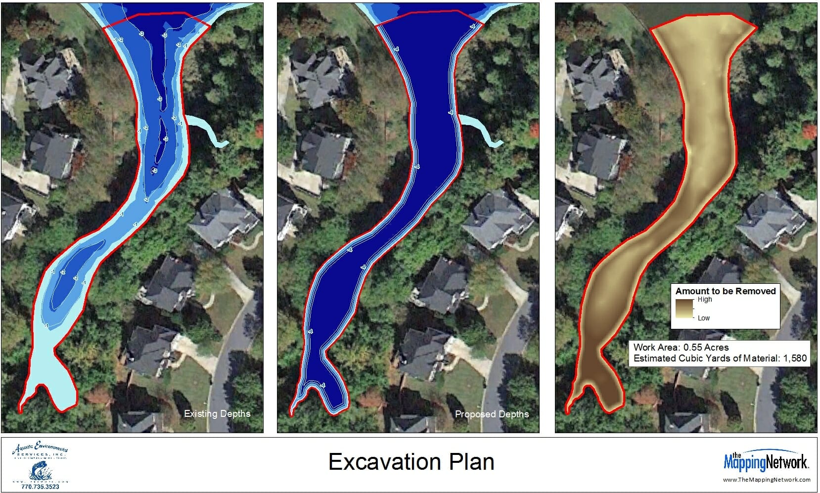
- A bathymetric and sedimentation study of the pond. We recommend that this is performed at least every five (5) years in conjunction with your Reserve Study to reveal changes in the pond.
- An appropriate contribution to your Reserve Account for the eventual replacement of the pond’s aeration (fountain or aerator) system.
- An appropriate contribution to your Reserve Account for the eventual need to dredge your pond.

Your Knowledge May be Beneath the Surface
Dredging is one of the most costly projects that a community or pond owner will incur during the life of a pond. Proper planning for a dredging project could mean cost savings. SŌLitude Lake Management recommends that you have a bathymetric study and sedimentation study periodically to make certain that the shape of your pond isn’t changing more rapidly than you are anticipating. Having the study performed on a regular basis will help to establish patterns and will assist in determining the size, magnitude and timing of dredging projects.
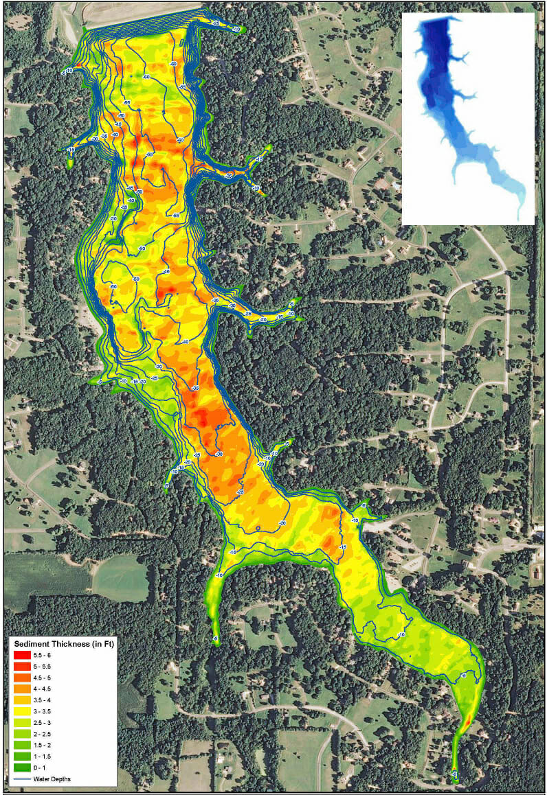
It is important to keep as many records on your pond as possible. A history of services, plans, bathymetry and major weather events is a good tool. If you have the original “as built” plans, they can be used to help determine the rate at which the pond is “filling in”. However, a better way to determine this is a sediment survey which measures the build-up and thickness of the sediment in your pond. A sediment survey can point out patterns and masses of build-up that can allow for a more focused dredge rather than a full-scale project.
Contact us today regarding bathymetry and sediment mapping for your pond. Knowing what lies beneath the surface is important for planning the future!

The Mapping Network is an industry leader in Hydrographic Surveys, Bathymetry, Geographic Information Systems Consulting, Data Conversion, and GPS Data Collection. We specialize in terrain and sub-surface (bathymetry) GPS mapping. If you are serious about maintaining a high-quality golf course, lake or pond, be sure you have the ability to make the best decisions, get your resource mapped by the professionals at The Mapping Network. Give us a call or send an e-mail to find out more details.
phone: (402) 241-8177
e-mail: [email protected]
website: www.themappingnetwork.com
Check out The Mapping Network on Facebook for more examples and success stories!
The Mapping Network is proud to announce their firm has been chosen by Cabela’s, the World’s Foremost Outfitter, as a Landowner Services provider for Cabela’s Trophy Properties throughout the United States. Visit us on the Cabela’s Trophy Properties website >> click here
The Mapping Network: www.TheMappingNetwork.com
A Nationwide Network of GPS Mapping Professionals
