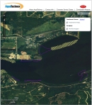
Aquatechnex Launches Web Based GIS Project Map
Aquatechnex will be treating Eurasian Milfoil on North Idaho’s Pend Oreille Lake and River this summer. This is the fourth year of this project and the Eurasian Milfoil populations have been significantly reduced.
One of the key things that needs to happen on a project like this is keeping the public up to date on treatments and water use restrictions. As this project spans over 60 miles of shoreline, using an interactive map tool on the internet is something that will really help people visualize the location of treatments and the progress of the operation.
The beta version of this is available (you may need to install Flash Player). Go to http://69.30.47.126/Aquatechnex/default.htm to view the project. There is a zoom in and out tool and you can drag the image around with your mouse to locate an area of interest. Turn off the toggle tool to clear that side of the screen. The Blue polygons are areas that will be treated with a granular product, the yellow areas are liquid Triclopyr areas and the Orange areas are liquid Triclopyr on Corps of Engineers project lands. We will be updating this as the treatment start to show areas not yet treated, those treated with irrigation restrictions and those treated where irrigation restrictions have expired.
More information on Aquatechnex can be found at their website: www.aquatechnex.com

