
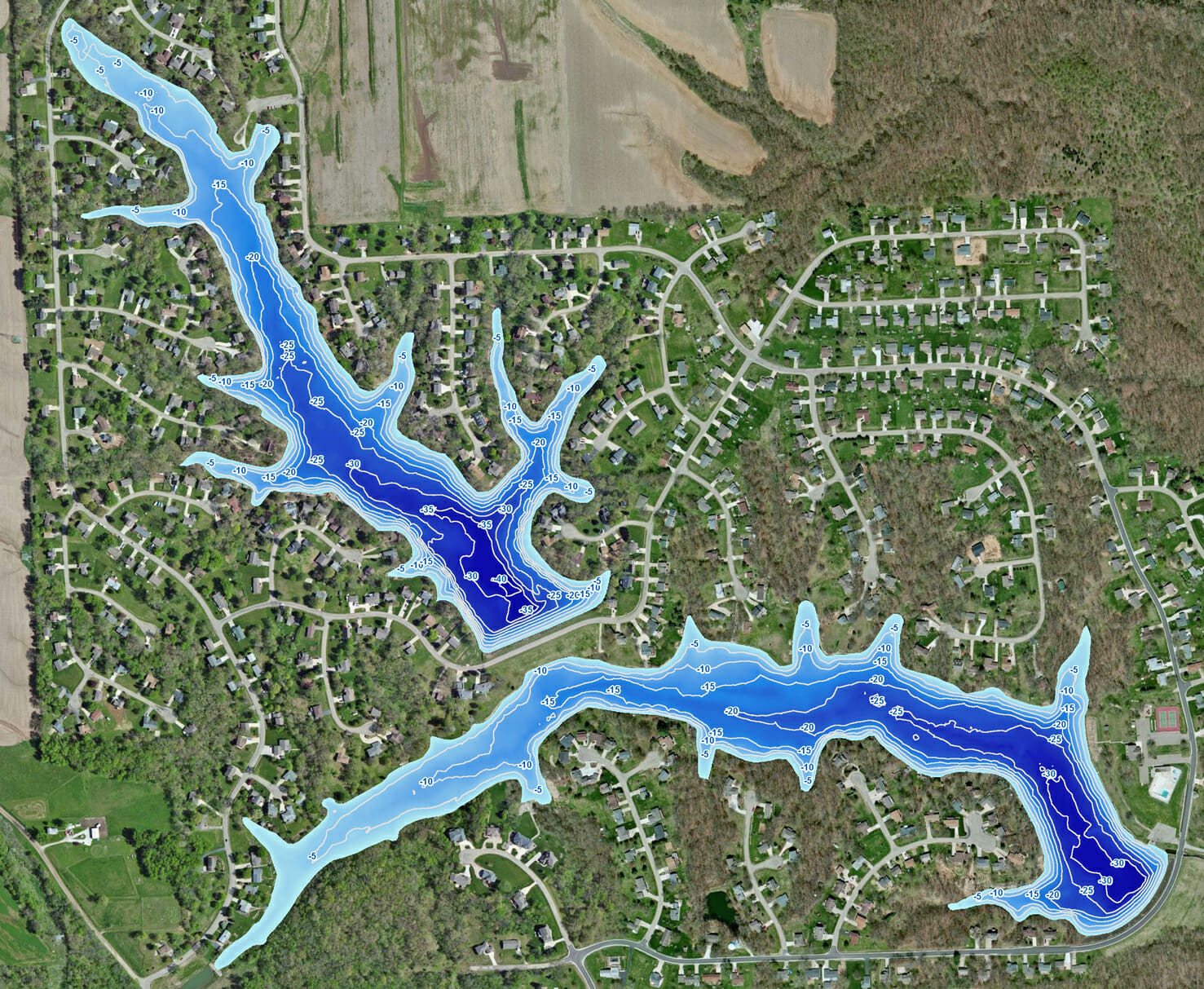
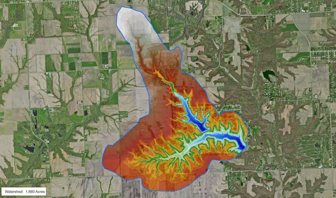
Bathymetry and Sediment Survey of Lake in Peoria, Illinois
A property association in Peoria, Illinois needed to quantify sediment build-up in their coves. The Mapping Network created a hydrographic and sediment survey of the two lakes and 20 coves. The amount of sediment in each cove was calculated along with other vitals stats about the current lake condition. A watershed map was also generated to help understand where sources of sediment are coming from.
About The Mapping Network:
The Mapping Network is an industry leader in Geographic Information Systems Consulting, Data Conversion, and GPS Data Collection. We specialize in terrain and sub-surface (bathymetry) GPS mapping, and recreational Real Estate listings. The Mapping Network is proud to announce their firm has been chosen by Cabela’s, the World’s Foremost Outfitter, as a Landowner Services provider for Cabela’s Trophy Properties throughout the United States. Visit us on the Cabela’s Trophy Properties website >> click here Give us a call or send an e-mail to find out more details.
phone: (402) 241-8177
e-mail: info@themappingnetwork.com
website: www.themappingnetwork.com
Check out The Mapping Network on Facebook for more examples and success stories!
![]()