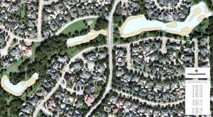
GPS Lake Mapping Verifies Dredging Project
Trent Lewis with Pond Medics, Inc. provided an Arlington, Texas Home Owner Association the validation of knowing a dredging project went as planned. Pond Medics, a lake mapping partner with The Mapping Network, charted the bottom of the lake before and after the dredging project to monitor the improvements. Not only was the HOA able to verify the work had been completed properly, they now have a basemap to monitor sediment accumulation over time. GPS bathymetric mapping is a powerful tool for assisting in management decisions.

