
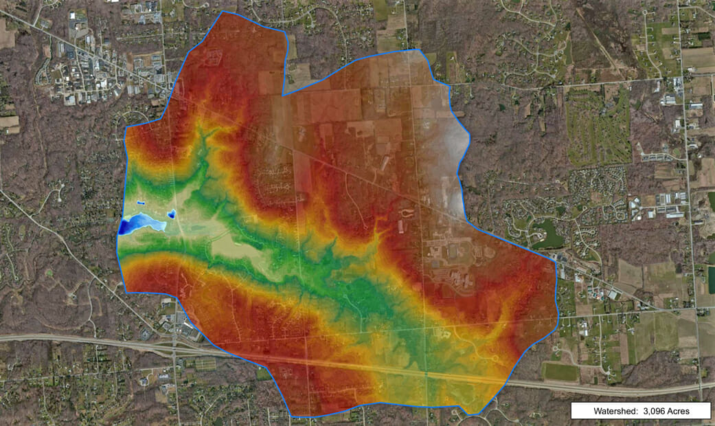
Measure the size of watershed to help understand sediment in lake?
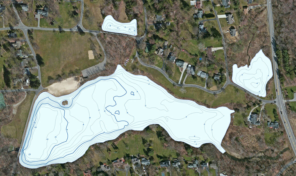
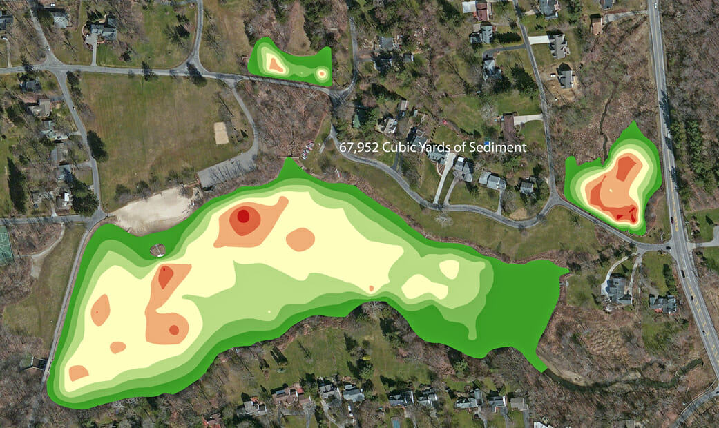
The Mapping Network created a hydrographic and sediment survey for a property owners association (POA). The main lake inlet has shallow water because sediment settles at the mouth of the stream, creating deltas. The POA installed two sediment basins to capture sediment flowing from the north. However, as shown on the watershed map, much more sediment is flowing from the east (this includes residential areas and a golf course). The POA needed to quantify sediment build-up in their sediment basins and the main lake.
The Mapping Network sampled the sediment structure and mapped the sludge thickness to help the client in the dredging bid process. Part of the report included understanding sources of sediment and how activity within the watershed will ultimately affect the lake. Below are maps showing the current water depth, sediment thickness, and total watershed.
About The Mapping Network:
The Mapping Network is an industry leader in Geographic Information Systems, GPS Data Collection, Aerial Imagery, and Data Conversion. We specialize in terrain and sub-surface (bathymetry) GPS mapping, topographic mapping, and aerial imagery. Give us a call or send an e-mail to find out more details.
phone: (402) 241-8177
e-mail: info@themappingnetwork.com
website: www.themappingnetwork.com
Check out The Mapping Network on Twitter or Facebook for more examples and success stories!
![]()