
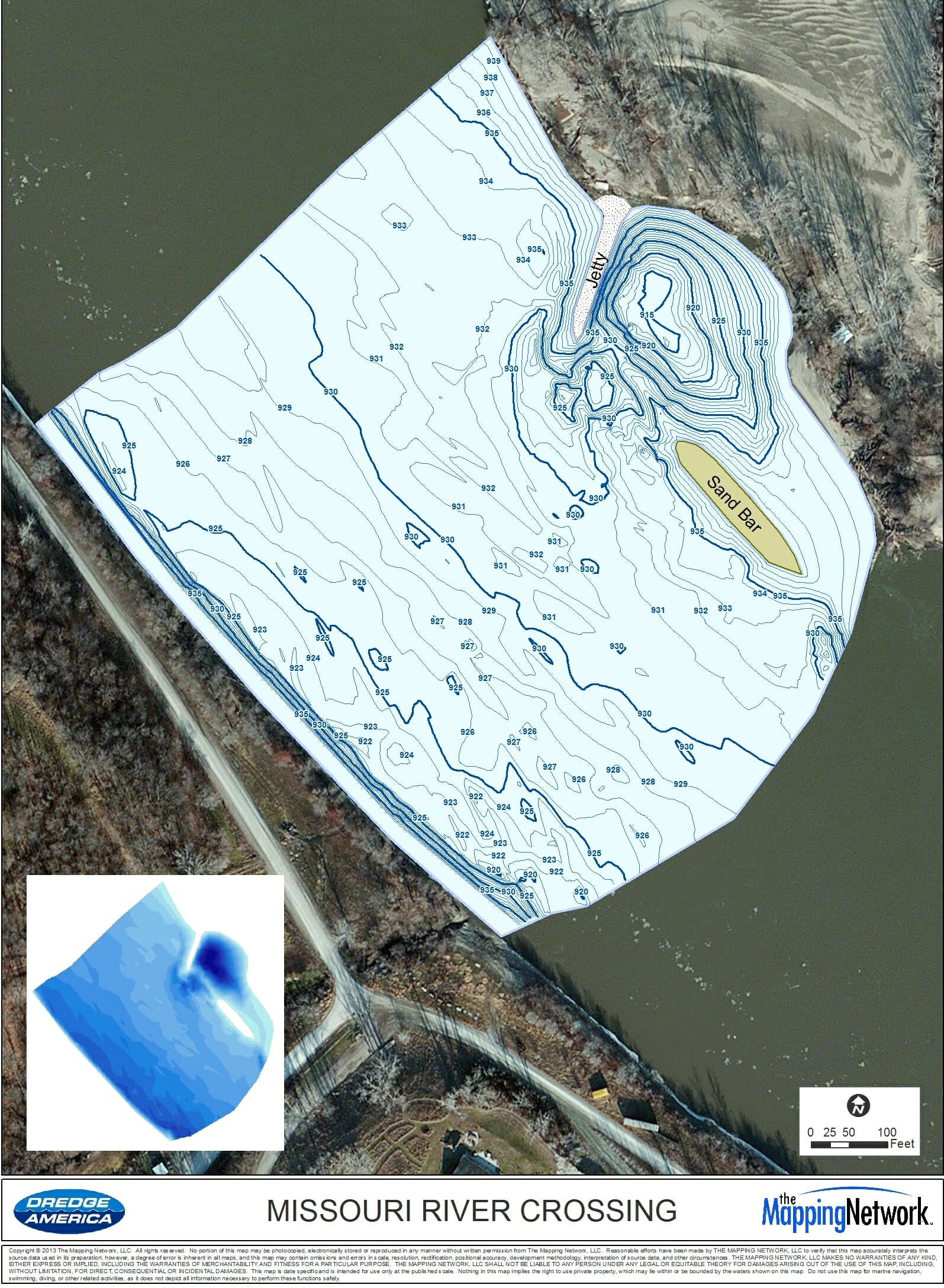
Hydrographic Survey of Missouri River for Gas Pipeline
The Mapping Network, Dredge America and Engineering firm team up to map the bottom of the Missouri River
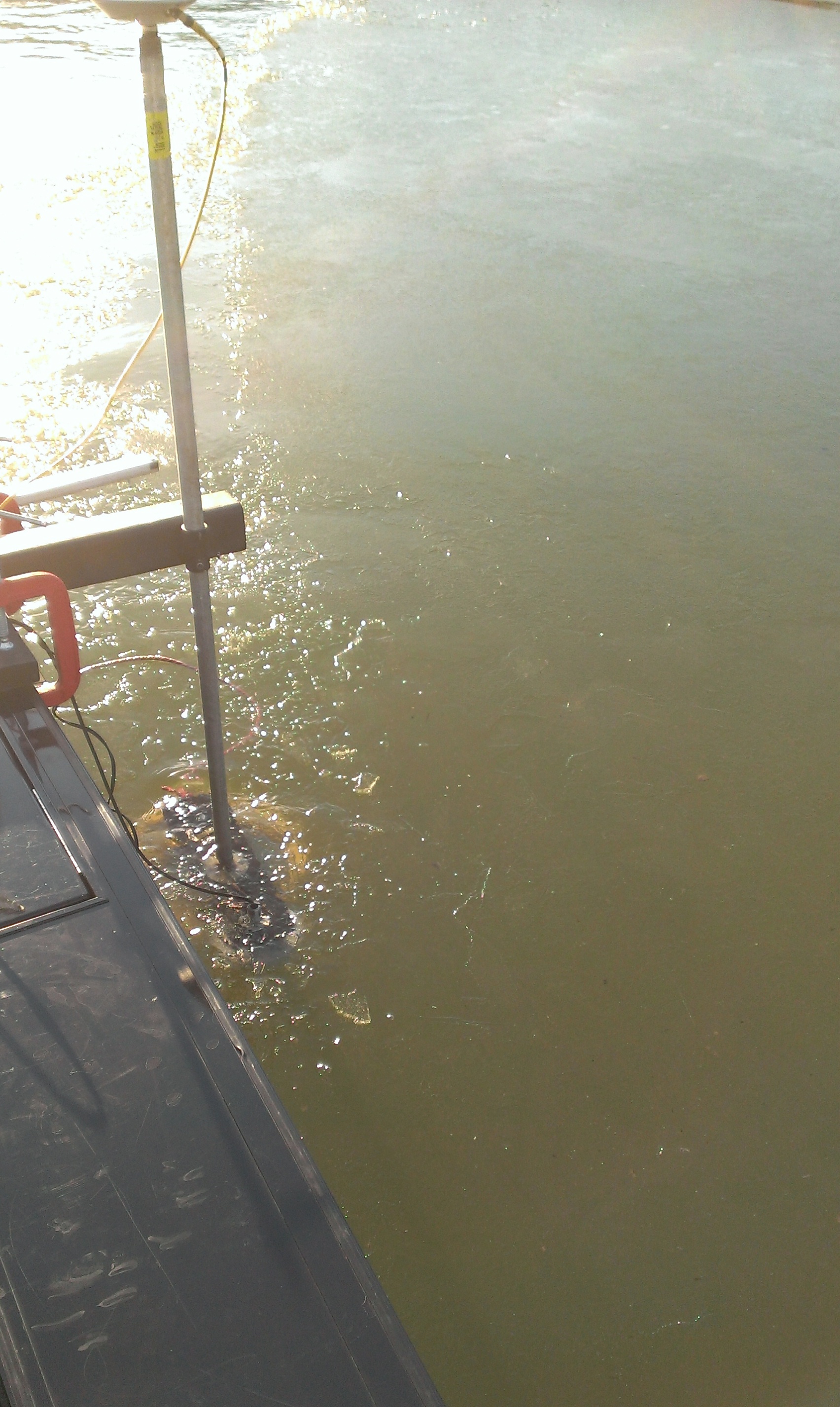
The Mapping Network and Dredge America spent several days scouting the Missouri River between Iowa and Nebraska. Why you ask? Because it is the middle of winter in this part of the country and there are many frozen dangers on the river this time of year. The survey team had to find the perfect time when mother nature allowed for safe passage on the river. After a week of above average temperatures the ice disappeared and the team jumped into action. The goal was to map a portion of the river where a gas pipeline would be crossing. The pipeline is buried deep below the river bottom and knowing the existing bottom of the Missouri River is crucial to engineers placing the pipeline correctly.
The survey team was able to finish the project on time despite dodging rogue chunks of ice, trees, sandbars (the current drought has the river at very low levels), other mysterious items floating down the river…and a broken prop! The resulting map shows many features you would expect to find on the Missouri River.
The Mapping Network is an industry leader in Hydrographic Surveys, Bathymetry, Geographic Information Systems Consulting, Data Conversion, and GPS Data Collection. We specialize in terrain and sub-surface (bathymetry) GPS mapping. If you are serious about maintaining a high-quality golf course, lake or pond, be sure you have the ability to make the best decisions, get your resource mapped by the professionals at The Mapping Network. Give us a call or send an e-mail to find out more details.
phone: (402) 241-8177
e-mail: info@themappingnetwork.com
website: www.themappingnetwork.com
Check out The Mapping Network on Facebook for more examples and success stories!
![]()
Dredge America, a leading US portable hydraulic dredging company, was established 20 years ago by Dan McDougal. They have both a small and medium sized dredge and perform projects across the United States. Please give them a call if you have any questions about sedimentation and dredging projects.
Website: www.dredgeamerica.com
email: info@themappingnetwork.com
Phone: 800.464.5597
Dredge America, Inc. is a professional, reliable and innovative leader in delivering portable hydraulic dredging services and geo-textile tube installation that exceeds our clients’ high expectations. We perform our dredging services for customers throughout the United States. Projects outside the U.S. in the western hemisphere are considered on a case by case basis.
Dredge America Dredging Services:
- Pond Dredging
- Golf Course and Lake Dredging
- Municipal and Industrial Lagoon Dredging
- Channel Dredging
- Harbor and Marina Dredging
- River Dredging
- Sand Dredging
——————————————————-
The Mapping Network: www.TheMappingNetwork.com
A Nationwide Network of GPS Mapping Professionals