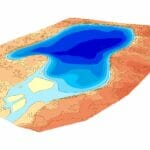
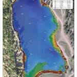
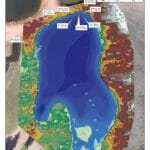
Hydrography and UAV/Drone Survey for Water Capacity Analysis
The Mapping Network conducted a hydrographic and topography survey for several trout ponds. They utilized Odom Sonar, Trimble RTK GPS, and Hypack to create the bathymetry. For the topography they used Trimble RTK GPS for control and a UAV / Drone to collect the images that produced the orthographic image and topography contours. All data was then input into ArcGIS for final processing.