
Iowa Reservoir Dredge Project Volume Calculations
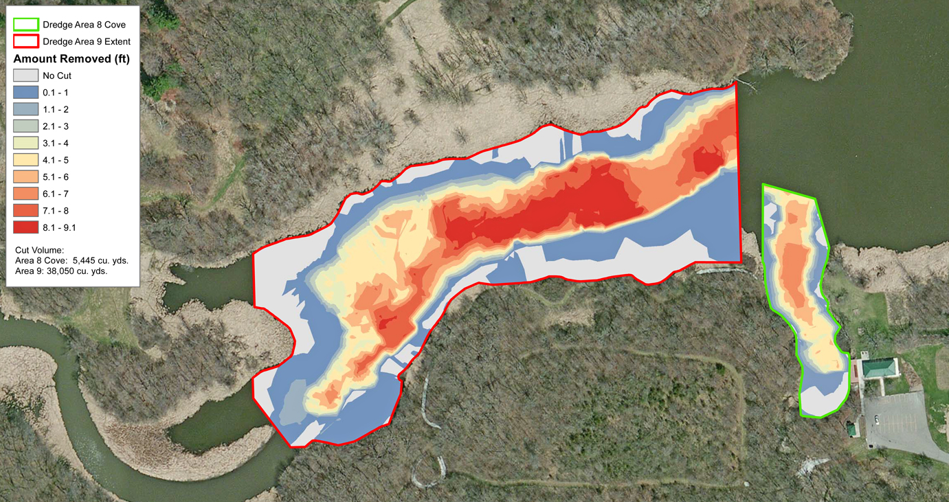
A 200 acre reservoir in Des Moines, Iowa is undergoing a comprehensive renovation. Part of the plan included dredging problem areas in the lake. Hydraulic dredging will remove this deposited sediment from the lake bottom, increase lake depth, and provide multiple recreation benefits for the public. The Mapping Network completed several bathymetry surveys to verify the dredging process was complete for each section. The Mapping Network generated maps to display the amount and location of material removed.
About The Mapping Network:
The Mapping Network is an industry leader in Geographic Information Systems, GPS Data Collection, Aerial Imagery, and Data Conversion. We specialize in terrain and sub-surface (bathymetry) GPS mapping, topographic mapping, and aerial imagery. Give us a call or send an e-mail to find out more details.
phone: (402) 241-8177
e-mail: info@themappingnetwork.com
website: www.themappingnetwork.com
Check out The Mapping Network on Twitter or Facebook for more examples and success stories!