
Is Your Storm Water Retention Basin Still Functional?
A common concern among pond owners is how much storage capacity has their retention basin lost since it was built? Overtime these basins fill in with sediment and lose their functionality for what they were designed. The big question is when does that happen?
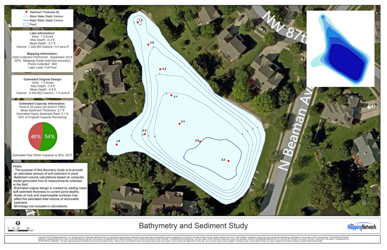
A client in Kansas City, Missouri knew their pond was losing depth, but wanted to find out how much? And how long did they have before dredging was needed? The Mapping Network surveyed the pond to model the current lake depths. Since there wasn’t any as-built plans for a baseline, sediment depths measurements were collected. Using the mean sediment thickness of the sampled points, The Mapping Network was able to estimate the original pond’s water volume capacity and also how much of the capacity the pond has remaining. The study discovered that in just 22 years, the pond only has 54% of it’s original capacity left. This information allows the pond management team to begin planning for a future dredging project on the pond.
Start planning for this future expense by contacting a professional within The Mapping Network today.
About The Mapping Network:
The Mapping Network is an industry leader in Geographic Information Systems Consulting, Data Conversion, and GPS Data Collection. We specialize in terrain and sub-surface (bathymetry) GPS mapping, and recreational Real Estate listings. Give us a call or send an e-mail to find out more details.
phone: (402) 241-8177
e-mail: info@themappingnetwork.com
website: www.themappingnetwork.com
Check out The Mapping Network on Facebook for more examples and success stories!
![]()