
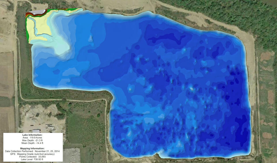
Land and Lake Survey of Active Sand and Gravel Mine
The Mapping Network provided a hydrographic and land survey of an active sand and gravel operation. The mining operation wanted a view of their lake bathymetry to see if there were any areas they still needed to dredge. The also will be using this information for an upcoming wetland creation project.
About The Mapping Network:
The Mapping Network is an industry leader in Geographic Information Systems, GPS Data Collection, Aerial Imagery, and Data Conversion. We specialize in terrain and sub-surface (bathymetry) GPS mapping, topographic mapping, and aerial imagery. Give us a call or send an e-mail to find out more details.
phone: (402) 241-8177
e-mail: info@themappingnetwork.com
website: www.themappingnetwork.com
Check out The Mapping Network on Twitter or Facebook for more examples and success stories!
![]()