
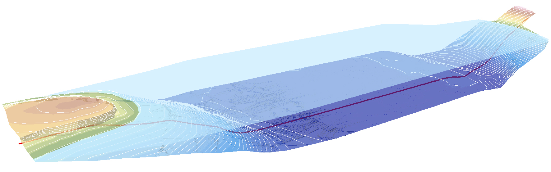
Land and Water Topography of Pipeline in Missouri
The Mapping Network and an engineering firm team up to perform a topographic survey on the land and a hydrographic survey on a portion of the lake where a new gas pipeline would be crossing. The pipeline is buried below the lake bottom and knowing the existing bottom of the lake is crucial to engineers placing the pipeline correctly.
About The Mapping Network:
The Mapping Network is an industry leader in Geographic Information Systems, GPS Data Collection, Aerial Imagery, and Data Conversion. We specialize in terrain and sub-surface (bathymetry) GPS mapping, topographic mapping, and aerial imagery. Give us a call or send an e-mail to find out more details.
phone: (402) 241-8177
e-mail: info@themappingnetwork.com
website: www.themappingnetwork.com
Check out The Mapping Network on Twitter or Facebook for more examples and success stories!
![]()