
Monitoring sediment in your lake
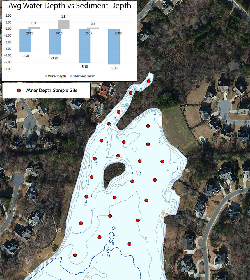
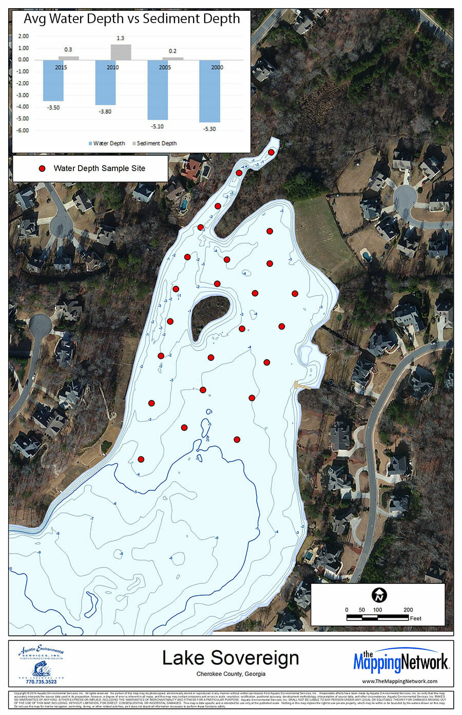
A partner within The Mapping Network helped a Home Owners Association (HOA) be proactive and monitored the inflow of sediment into their lake based upon five-year intervals. Comparing water and sediment depth data from 2000, 2005, 2010, and 2015 the HOA discovered a increase in sediment rate from 2005-2010 due to heavy construction upstream.
This data helped the HOA establish baseline information on their lake and aided them with facts for working with developers who were responsible for the sediment. It is crucial to have a professional monitoring the sedimentation in your lake or pond to help protect you from sedimentation that occurs outside of normal rates.
The Mapping Network is an industry leader in Geographic Information Systems, GPS Data Collection, Aerial Imagery, and Data Conversion. We specialize in terrain and sub-surface (bathymetry) GPS mapping, topographic mapping, and aerial imagery. Give us a call or send an e-mail to find out more details.
phone: (402) 241-8177
e-mail: info@themappingnetwork.com
website: www.themappingnetwork.com
Check out The Mapping Network on Twitter or Facebook for more examples and success stories!
![]()