
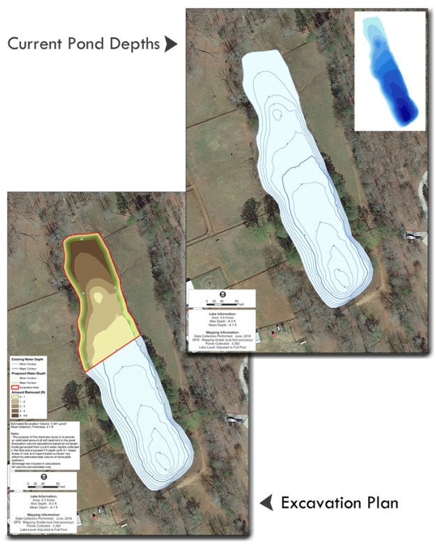
Pond Water Depth and Excavation Plan in Atlanta, Georgia
The Mapping Network and Aquatic Environmental Services teamed up to create a bathymetric study and excavation plan for a homeowner near Atlanta, Georgia. The owner wants to achieve a minimum 3 foot water depth in the entire pond. 3D models comparing the proposed lake bottom with the existing lake bottom and calculated the amount of hard material to be removed. This critical information will be used to assist with bids for dredging contractors to remove all the material.
About The Mapping Network:
The Mapping Network is an industry leader in Geographic Information Systems, GPS Data Collection, Aerial Imagery, and Data Conversion. We specialize in terrain and sub-surface (bathymetry) GPS mapping, topographic mapping, and aerial imagery. Give us a call or send an e-mail to find out more details.
phone: (402) 241-8177
e-mail: info@themappingnetwork.com
website: www.themappingnetwork.com
Check out The Mapping Network on Twitter or Facebook for more examples and success stories!