Sediment Mapping and Analysis Project from Foster Lake Management
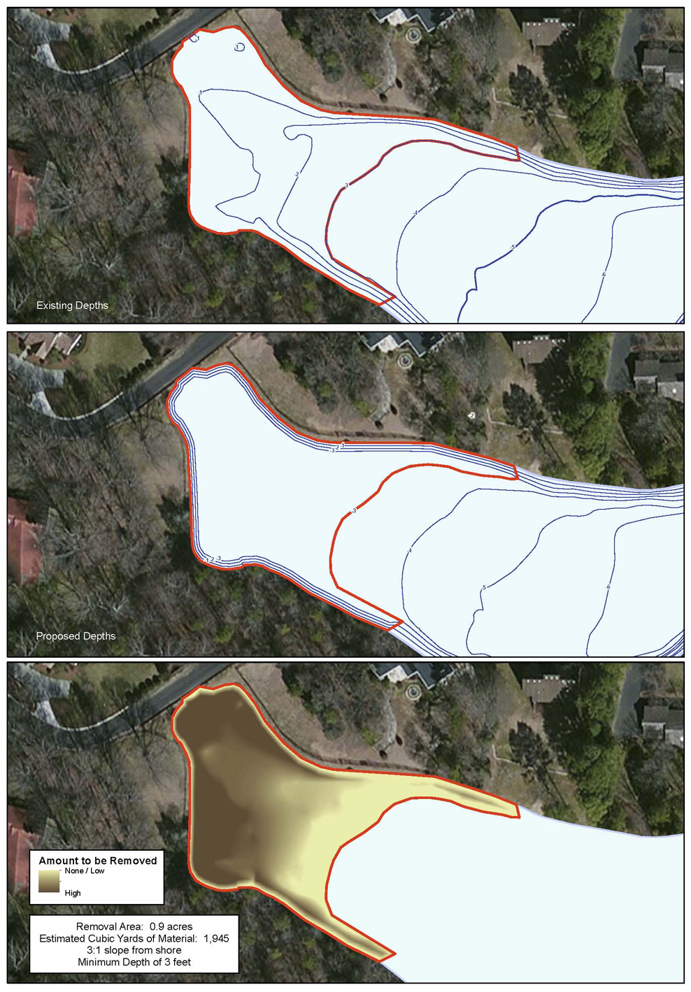
Foster Lake Management recently completed a mapping project for a home owners association in North Carolina. The inlet area of the lake is suffering from sediment buildup. The overall goals of the lake mapping project involved surveying the depths of the entire lake, collecting sediment depth samples, calculating the amount of sediment currently in the inlet area and creating a dredge plan for a minimum water depth of 3 feet. Foster Lake Management collected water depths over the entire lake and fluffy sediment levels for the inlet areas. The Mapping Network then generated detailed hydrographic maps, 3D models, and sediment volume maps for the inlet area. The HOA is now in the process of selecting bids for the removal of sediment to attain the 3 foot minimum depth.
Here at The Mapping Network, we specialize in accurately mapping bodies of water, calculating the water volume, collecting sediment depth samples at critical areas and monitoring the distribution of sediment over time. We have a nationwide group of professionals specializing in all facets of lake management.
The bottom line – This powerful information allows for smart management and planning decisions and will serve as a baseline for future projects. A great value!

The Mapping Network is an industry leader in Geographic Information Systems Consulting, Data Conversion, and GPS Data Collection. We specialize in terrain and sub-surface (bathymetry) GPS mapping. If you are serious about maintaining a high-quality golf course, lake or pond, be sure you have the ability to make the best decisions, get your resource mapped by the professionals at The Mapping Network. Give us a call or send an e-mail to find out more details.
phone: (402) 241-8177
e-mail: info@themappingnetwork.com
website: www.themappingnetwork.com
Check out The Mapping Network on Facebook for more examples and success stories!
The Mapping Network is proud to announce their firm has been chosen by Cabela’s, the World’s Foremost Outfitter, as a Landowner Services provider for Cabela’s Trophy Properties throughout the United States. Visit us on the Cabela’s Trophy Properties website >> click here
The Mapping Network: www.TheMappingNetwork.com
