
Excavation
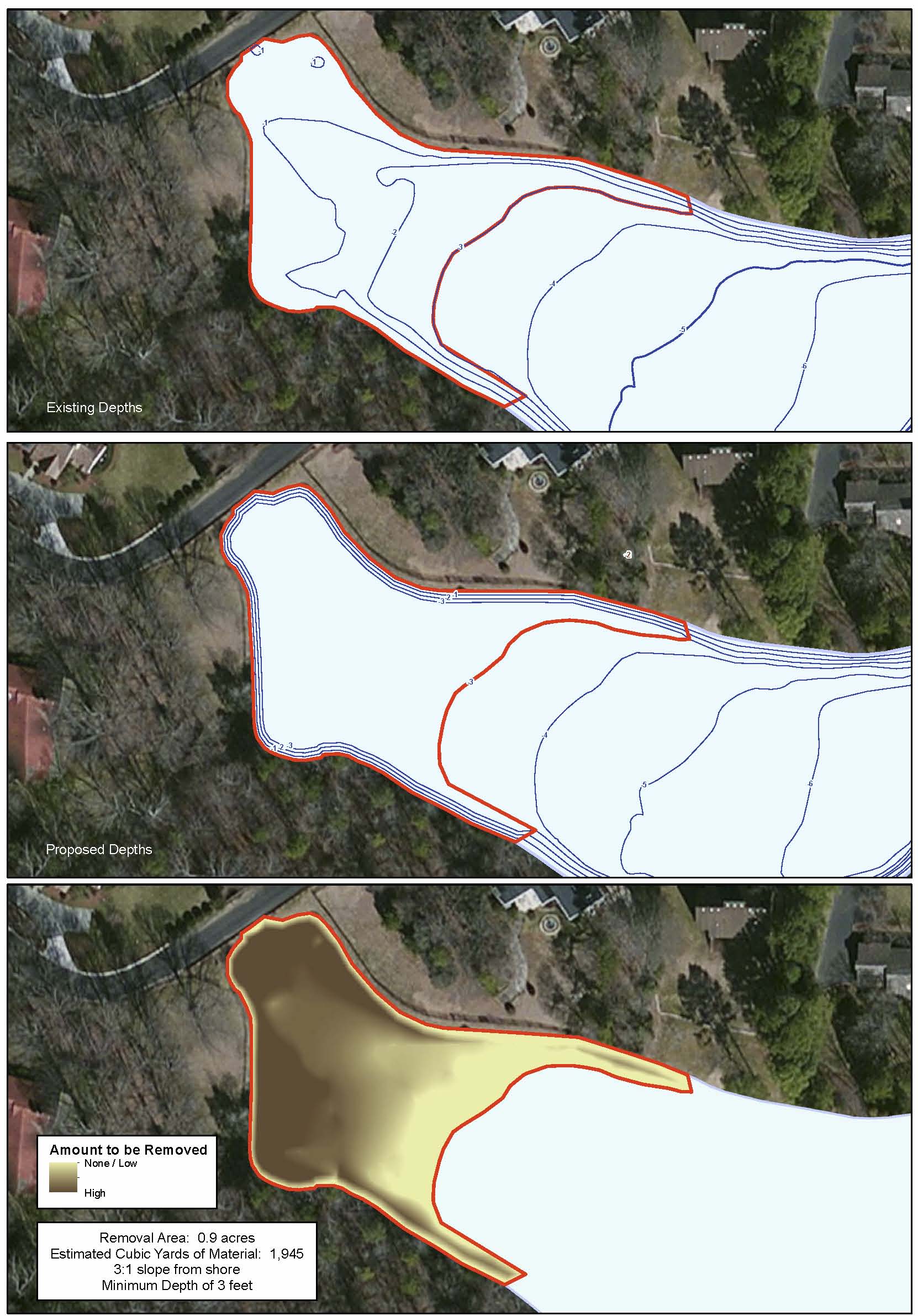
In the maps above, the HOA needed the depths of the cove to be a minimum of 3 foot for boat access. Mapping Network located the areas where the current depth was less than 3 feet, which was the dredging zone. The Mapping Network calculated the dredging area and volume. The current lake bathymetry (left) and the post-dredge contours (middle) are shown in blue shading. A cut-fill model (right) shows areas of cut needed to reach the goal.