
Monitoring Sediment Removal of Dredging Project
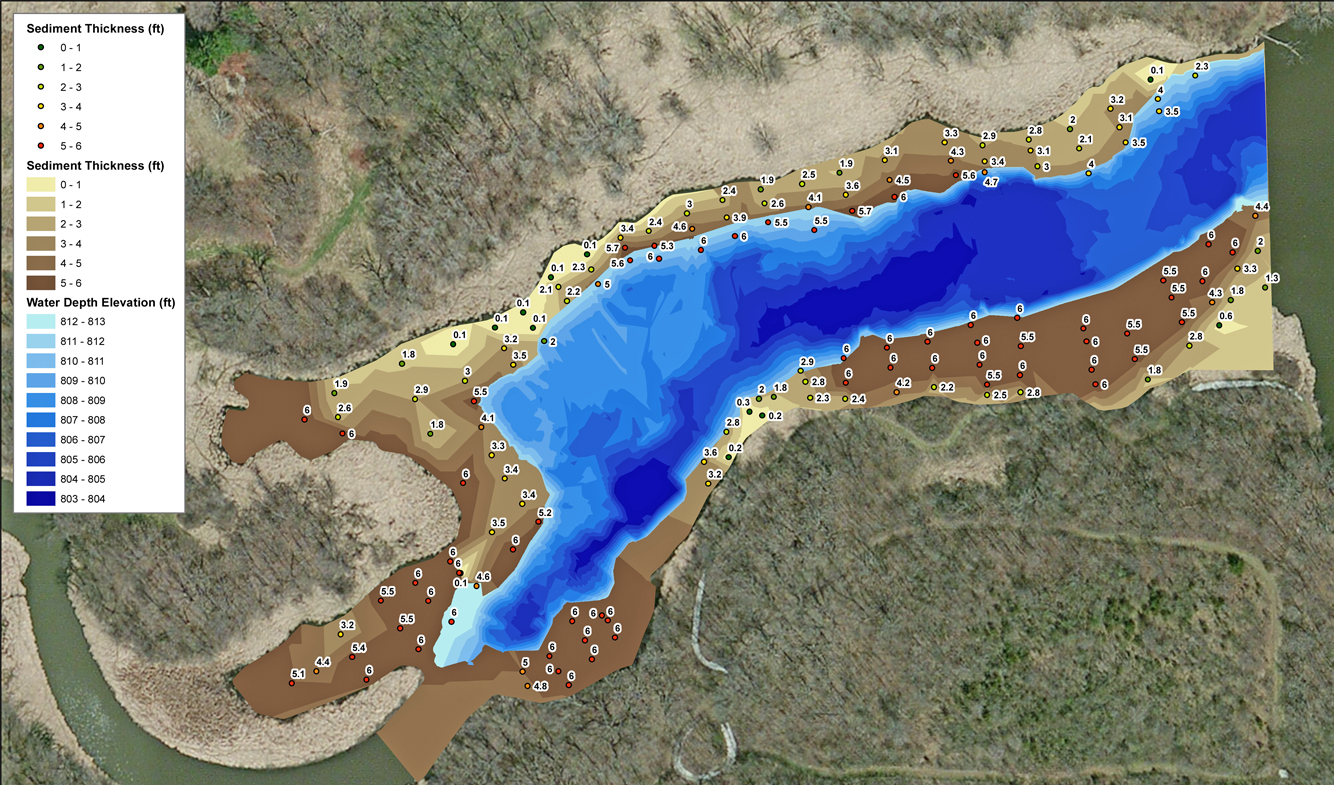
The Mapping Network completed a hydrographic survey to show the current dredging status for a reservoir in Iowa. The survey crew also collected sediment measurements to quantify the amount of soft sediment remaining in the dredge zone. The Mapping Network generated maps to display the amount and location of material yet to be removed. This information allows the client and dredge contractor to plan the remaining dredge schedule for the project.
About The Mapping Network:
The Mapping Network is an industry leader in Geographic Information Systems, GPS Data Collection, Aerial Imagery, and Data Conversion. We specialize in terrain and sub-surface (bathymetry) GPS mapping, topographic mapping, and aerial imagery. Give us a call or send an e-mail to find out more details.
phone: (402) 241-8177
e-mail: info@themappingnetwork.com
website: www.themappingnetwork.com
Check out The Mapping Network on Twitter or Facebook for more examples and success stories!