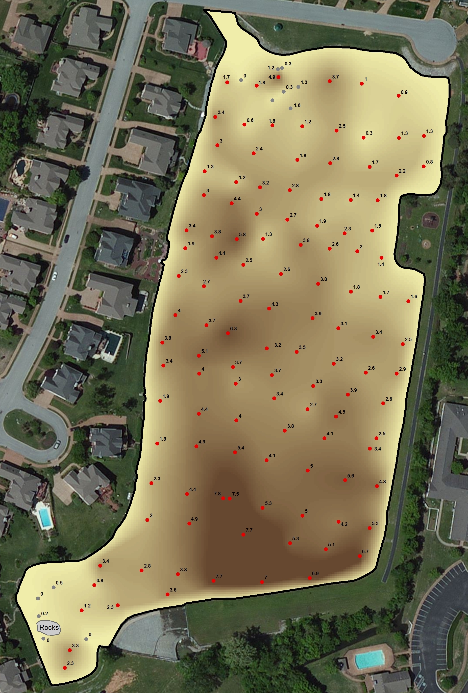
Start a Sediment Plan with a Map
Here at The Mapping Network, we understand the challenges and costs associated with locating and removing sediment. We specialize in accurately mapping bodies of water, calculating the water volume, collecting sediment depth samples at critical areas and monitoring the distribution of sediment over time.
Common questions from our clients:
- Where is the highest sedimentation occurring?
- How much fluffy sediment (in cubic yards) is in each cove?
- If the lake is drawn down 5 ft, what would the shoreline look like?
- How much water (gallons and acre-ft) is in the lake?
- If we make each cove a minimum of 4 feet deep for boat access how much material do we need to remove?
- By undertaking this mapping process will it save us money in the end?
Each of these questions can be answered by mapping the lake using The Mapping Network’s system. We are able to locate the problems areas and calculate the volume (in cubic yards) of material to be removed. The lake mapping data allows us to show the new shoreline if a lake is drawn down 1 ft, 5 ft, 10 ft, etc. Also, calculating water volume at various lake levels can be done. One of the best aspects of the mapping process is it allows the owner and contractor to be on the same page. Successful planning and execution of the dredging project can ensue. We have seen clients save tremendous amounts of money by using The Mapping Network to survey their lake before undertaking the dredging process.
The time to act is now. Don’t waste another year trying to manage your resource without this information.

About The Mapping Network:
The Mapping Network is an industry leader in Geographic Information Systems Consulting, Data Conversion, and GPS Data Collection. We specialize in terrain and sub-surface (bathymetry) GPS mapping, and recreational Real Estate listings. The Mapping Network is proud to announce their firm has been chosen by Cabela’s, the World’s Foremost Outfitter, as a Landowner Services provider for Cabela’s Trophy Properties throughout the United States. Visit us on the Cabela’s Trophy Properties website >> click here Give us a call or send an e-mail to find out more details.
phone: (402) 241-8177
e-mail: info@themappingnetwork.com
website: www.themappingnetwork.com
Check out The Mapping Network on Facebook for more examples and success stories!
