
Water Intake Dredge Comparison Map
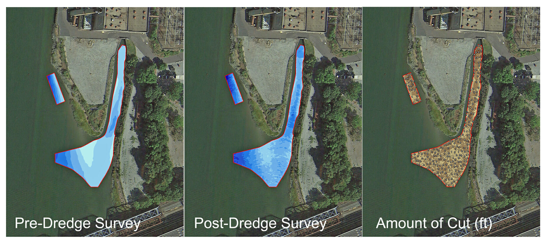
The Mapping Network completed a bathymetry survey to show the status of a dredging project for an intake to a power plant. The comparison map was calculated to verify the amount and location of material removed. Areas still needing to be dredged are located and the dredging contractor will focus their efforts on those locations. This verifies the dredging has reached the planned depths.
About The Mapping Network:
The Mapping Network is an industry leader in Geographic Information Systems, GPS Data Collection, Aerial Imagery, and Data Conversion. We specialize in terrain and sub-surface (bathymetry) GPS mapping, topographic mapping, and aerial imagery. Give us a call or send an e-mail to find out more details.
phone: (402) 241-8177
e-mail: info@themappingnetwork.com
website: www.themappingnetwork.com
Check out The Mapping Network on Twitter or Facebook for more examples and success stories!
![]()