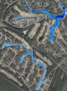
Lake Mapping Project for North Carolina Lake Association
Bathymetric Lake Mapping was performed by Virginia Lake Management for a 720-home master planned golf and lake community in North Carolina. The purpose of this project was to create a base map and calculate water volume for each lake in the development. Virgina Lake Management mapped the current lake depths along with collecting GPS coordinates for inflows, culverts, docks, fish feeders and other water features. Using this new, accurate data, the lake community will be able to easily locate infrastructure on the property and also monitor sedimentation problem areas.
The finished project included a Bathymetric Lake Map with 3D Color-shaded depths and contour map with locations of high risk sediment areas.
More information on Virginia Lake Management Company visit their website: www.virginialakemanagement.com
The Mapping Network: www.TheMappingNetwork.com
A Nationwide Network of GPS Mapping Professionals

