
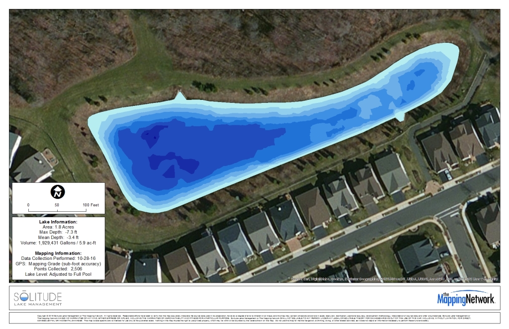
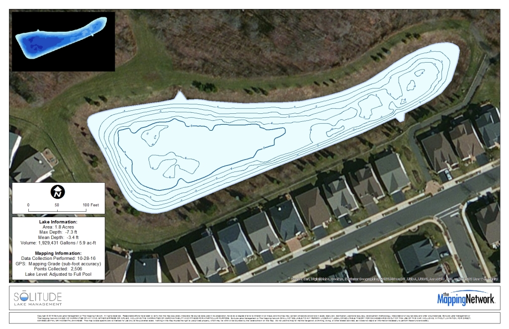
Bathymetry and Sediment Mapping in New Jersey
The Mapping Network was contacted by Solitude Lake Management to perform a bathymetric and sediment evaluation of a specific pond. This evaluation will then be used for Dredging of the area. We converted their Trimble SSF file of bathymetric data over to GIS data to then be used for mapping. Our Geospatial Analyst then produced three visuals: 3D Bathymetry Map, Contour Bathymetry Map, and a Sediment Thickness Map. These will provide the Technicians in the field great guidance for their dredging purposes.

About The Mapping Network:
The Mapping Network is an industry leader in Geographic Information Systems, GPS Data Collection, Aerial Imagery, and Data Conversion. We specialize in terrain and sub-surface (bathymetry) GPS mapping, topographic mapping, and aerial imagery. Give us a call or send an e-mail to find out more details.
phone: (402) 241-8177
e-mail: info@themappingnetwork.com
website: www.themappingnetwork.com
Check out The Mapping Network on Twitter or Facebook for more examples and success stories!