
Hydrographic Survey of Missouri River for Gas Pipeline
The Mapping Network and Engineering firm team up to map the bottom of the Missouri River
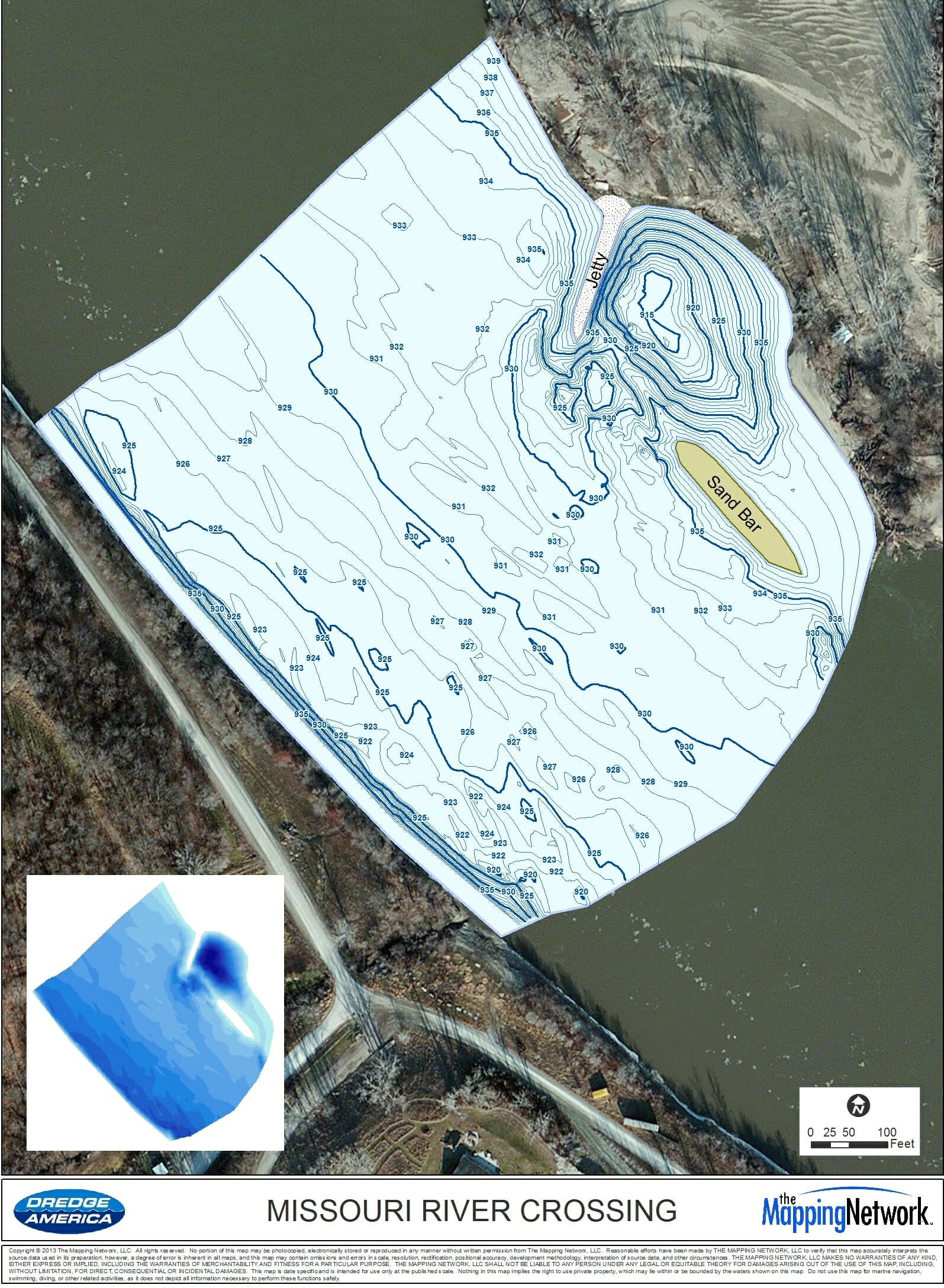
The Mapping Network was on the Missouri River performing a hydrographic survey on a portion of the river where a new gas pipeline would be crossing. The pipeline is buried below the river bottom and knowing the existing bottom of the Missouri River is crucial to engineers placing the pipeline correctly.
The survey team was able to finish the project on time despite dodging rogue chunks of trees, sandbars and other mysterious items floating down the river. The resulting map shows many features you would expect to find on the Missouri River.
About The Mapping Network:
The Mapping Network is an industry leader in Geographic Information Systems, GPS Data Collection, Aerial Imagery, and Data Conversion. We specialize in terrain and sub-surface (bathymetry) GPS mapping, topographic mapping, and aerial imagery. Give us a call or send an e-mail to find out more details.
phone: (402) 241-8177
e-mail: info@themappingnetwork.com
website: www.themappingnetwork.com
Check out The Mapping Network on Twitter or Facebook for more examples and success stories!