
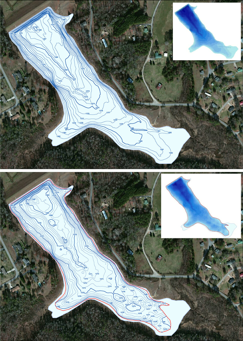
Calculating Sediment for Dredging Plan in Georgia
Aquatic Environmental Services, a lake mapping partner within The Mapping Network completed a lake survey for a reservoir near Atlanta, Georgia. The current water depths were mapped as well as the depth to hard bottom. The difference between the current water depth (top of sediment) and the hard bottom is the amount of soft sediment that can be removed to bring the lake back to the original depths. The client is preparing for dredging proposals and they needed to know the current water volume and the amount of material to be removed to achieve full capacity.
About The Mapping Network:
The Mapping Network is an industry leader in Geographic Information Systems, GPS Data Collection, Aerial Imagery, and Data Conversion. We specialize in terrain and sub-surface (bathymetry) GPS mapping, topographic mapping, and aerial imagery. Give us a call or send an e-mail to find out more details.
phone: (402) 241-8177
e-mail: info@themappingnetwork.com
website: www.themappingnetwork.com
Check out The Mapping Network on Twitter or Facebook for more examples and success stories!
![]()