
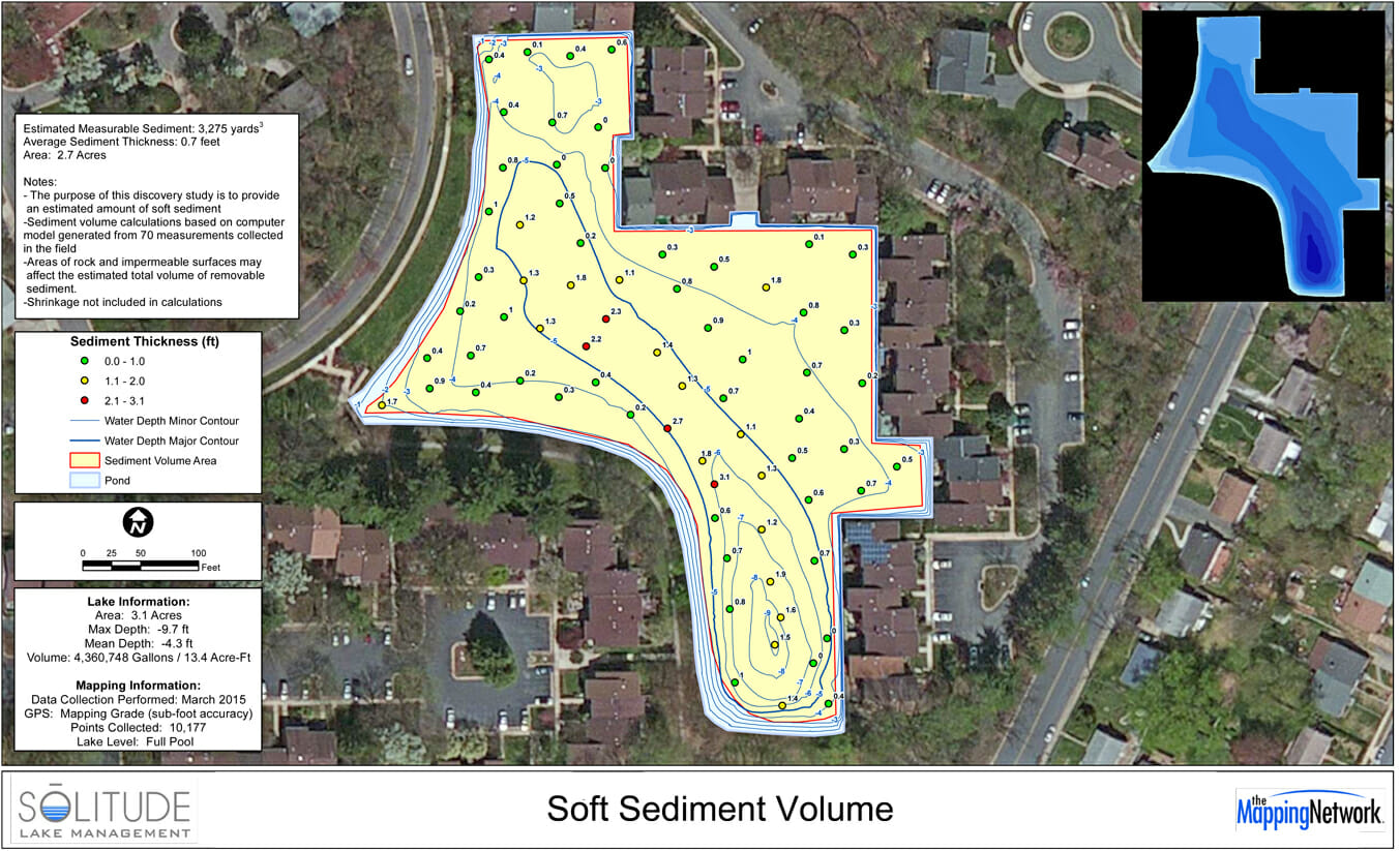
Measuring Sediment Volume in a Pond
Solitude Lake Management created a bathymetry and a sediment volume study for a home owners association in Virginia. The pond was mapped to understand current water depths and to calculate the amount of accumulated sediment. This information with assist the HOA with long term management planning of the water body.
About The Mapping Network:
The Mapping Network is an industry leader in Geographic Information Systems, GPS Data Collection, Aerial Imagery, and Data Conversion. We specialize in terrain and sub-surface (bathymetry) GPS mapping, topographic mapping, and aerial imagery. Give us a call or send an e-mail to find out more details.
phone: (402) 241-8177
e-mail: info@themappingnetwork.com
website: www.themappingnetwork.com
Check out The Mapping Network on Twitter or Facebook for more examples and success stories!
![]()