
Controlling Aquatic Vegetation in Texas Lake
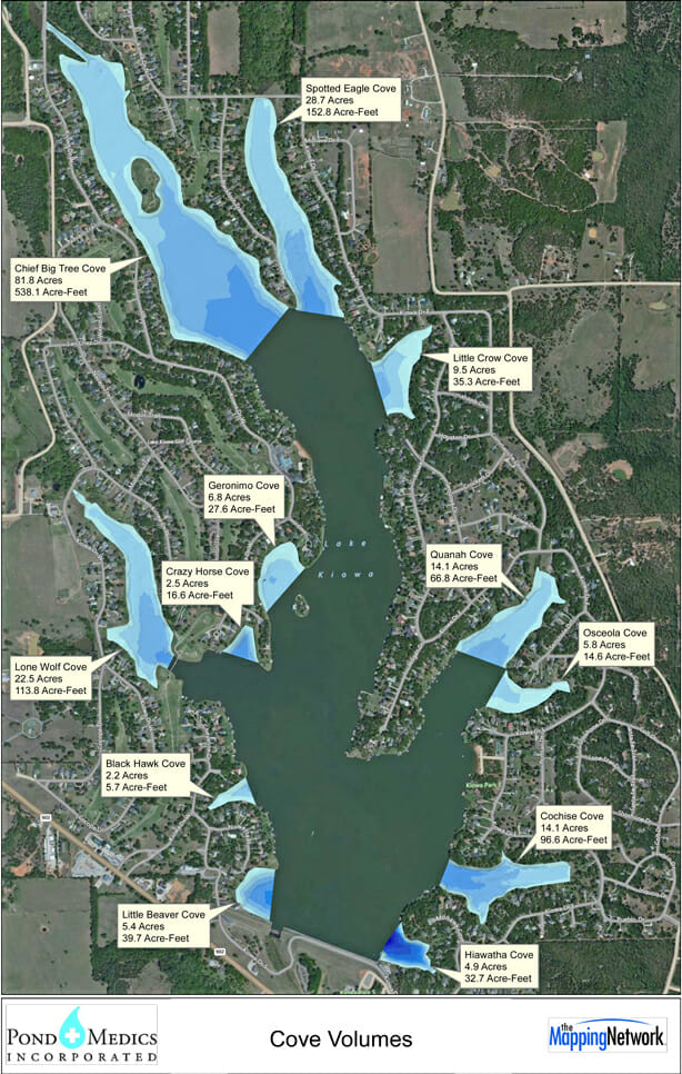
Pond Medics completed a bathymetry and sediment study in the Dallas-Fort Worth area for a 520 acre lake. The client required accurate water depths and volumes for each cove as they plan for future dredging options. The information will also be used to calculate aquatic vegetation treatment applications.
About The Mapping Network:
The Mapping Network is an industry leader in Geographic Information Systems, GPS Data Collection, Aerial Imagery, and Data Conversion. We specialize in terrain and sub-surface (bathymetry) GPS mapping, topographic mapping, and aerial imagery. Give us a call or send an e-mail to find out more details.
phone: (402) 241-8177
e-mail: info@themappingnetwork.com
website: www.themappingnetwork.com
Check out The Mapping Network on Twitter or Facebook for more examples and success stories!
![]()