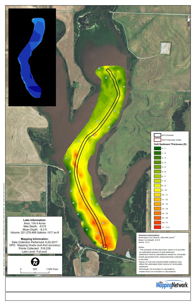
Dredge Channel Planning Using Soft Sediment Analysis
The Mapping Network performed a pre-dredge and sediment study on a county reservoir. Their mission was to locate a historic channel buried under several feet of soft sediment. The Mapping Network had to carefully examine the sonar readings and sediment probe information to best locate the channel. The result of the analaysis providing accurate information to plot the idea course for the dredger to input into their Dredgepak software system.