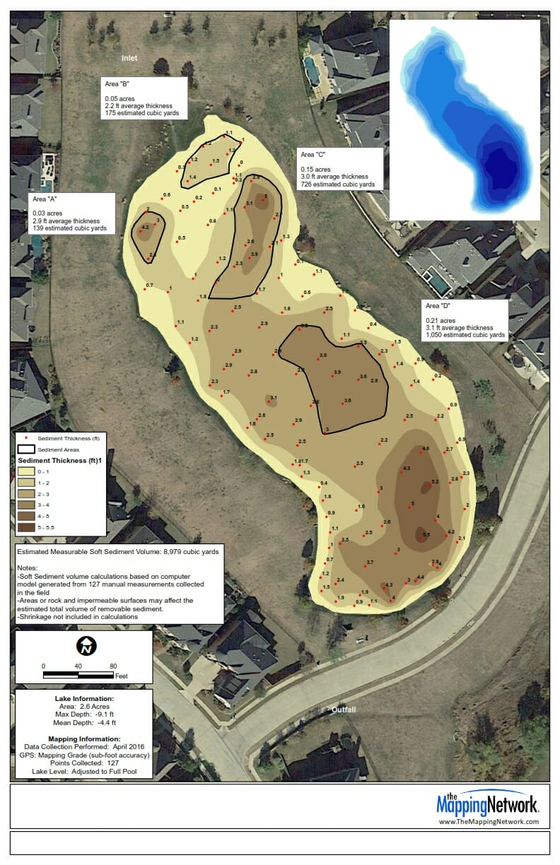
Lake Sediment – Volumetric Precision
The Mapping Network previously conducted a hydrographic survey to analyze the amount of sediment in a lake. After determining cost of sediment removal, the lake owner decided to dredge specific locations of sediment. The Mapping Network was able to perform volume calculations on the precise boundaries without any additional surveying.