The Mapping NetworkThe Mapping NetworkThe Mapping NetworkThe Mapping Network
  • Hydrography
  • Sediment Mapping
  • Dredging
  • News
  • ARCHIVES
  • Contact Us

Dredge Progress Map

Home / News / Uncategorized / Dredge Progress Map

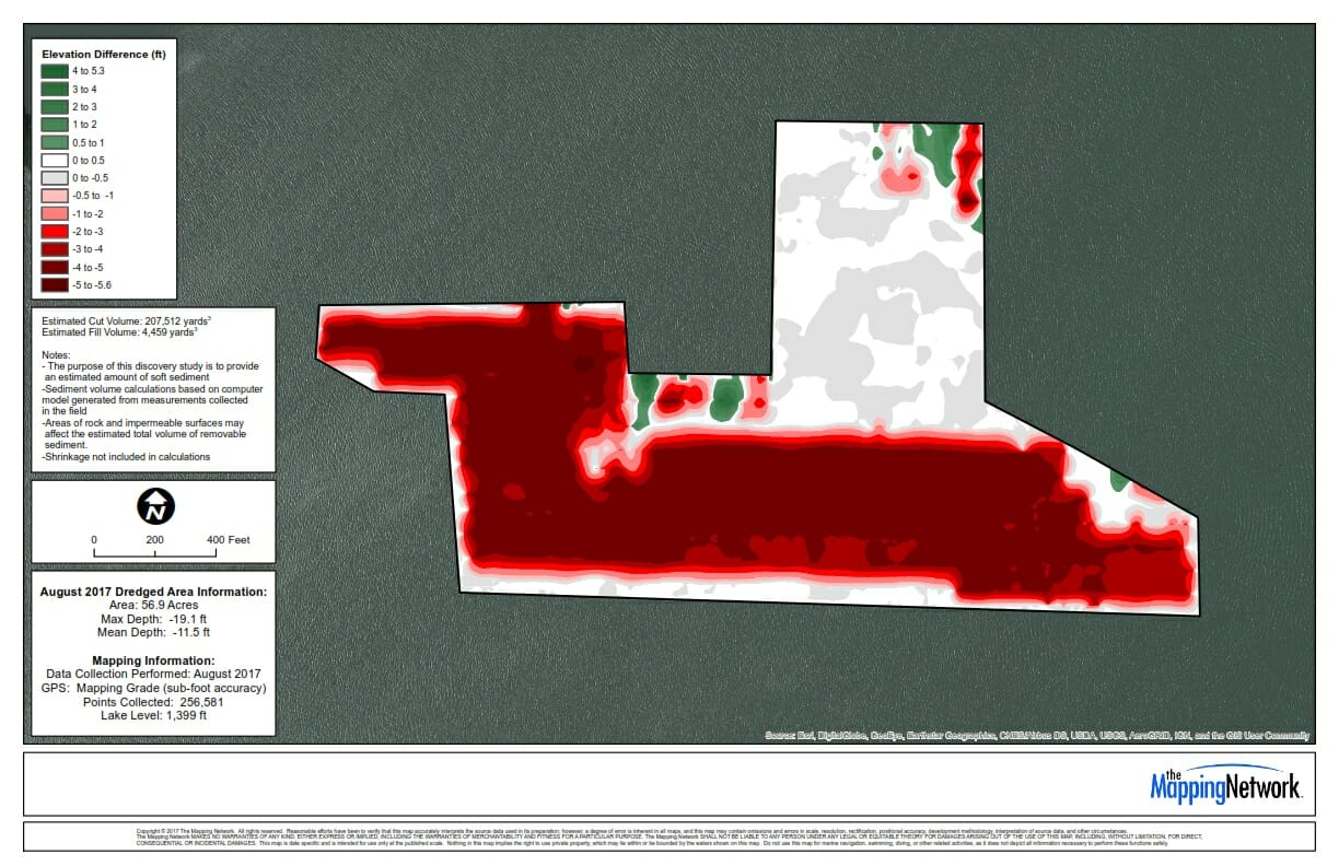
Hydrography and UAV/Drone Survey for Water Capacity Analysis
Missouri River Intake Hydrographic Survey

Dredge Progress Map

The Mapping Network provided an interim post-dredge survey for a Department of Natural Resources.  We provided a hydrographic survey and created a comparison model to calculate the amount of sediment removed from the area.

StormLake_2017_Adjusted_001

22
Feb 2018

© 2023 The Mapping Network – ALL RIGHTS RESERVED. 5201 N 97th St., Kansas City, KS 66109 | 402-241-8177 | [email protected].

Social Media Icons

Visit Us On TwitterVisit Us On FacebookVisit Us On Linkedin
  • Hydrography
  • Sediment Mapping
  • Dredging
  • News
  • ARCHIVES
  • Contact Us