
Hydrogaphic Survey for Dredge Quantity Verification
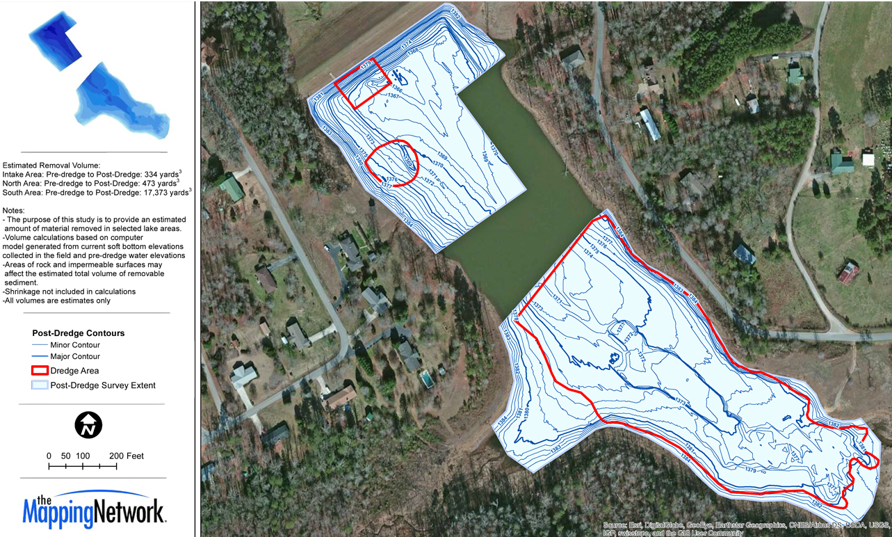
The Mapping Network completed a hydrographic survey to show the status of a dredging project for a drinking water reservoir. A combination of Hypack, RTK GPS, and Odom CV100 Sonar was used to collect and process he bathymetry data. A comparison with the pre-dredge survey was calculated to verify the amount and location of material removed. This verifies the dredging has reached the planned depths and keeps all parties on the same page.
About The Mapping Network:
The Mapping Network is an industry leader in Geographic Information Systems, GPS Data Collection, Aerial Imagery, and Data Conversion. We specialize in terrain and sub-surface (bathymetry) GPS mapping, topographic mapping, and aerial imagery. Give us a call or send an e-mail to find out more details.
phone: (402) 241-8177
e-mail: info@themappingnetwork.com
website: www.themappingnetwork.com
Check out The Mapping Network on Twitter or Facebook for more examples and success stories!
![]()