
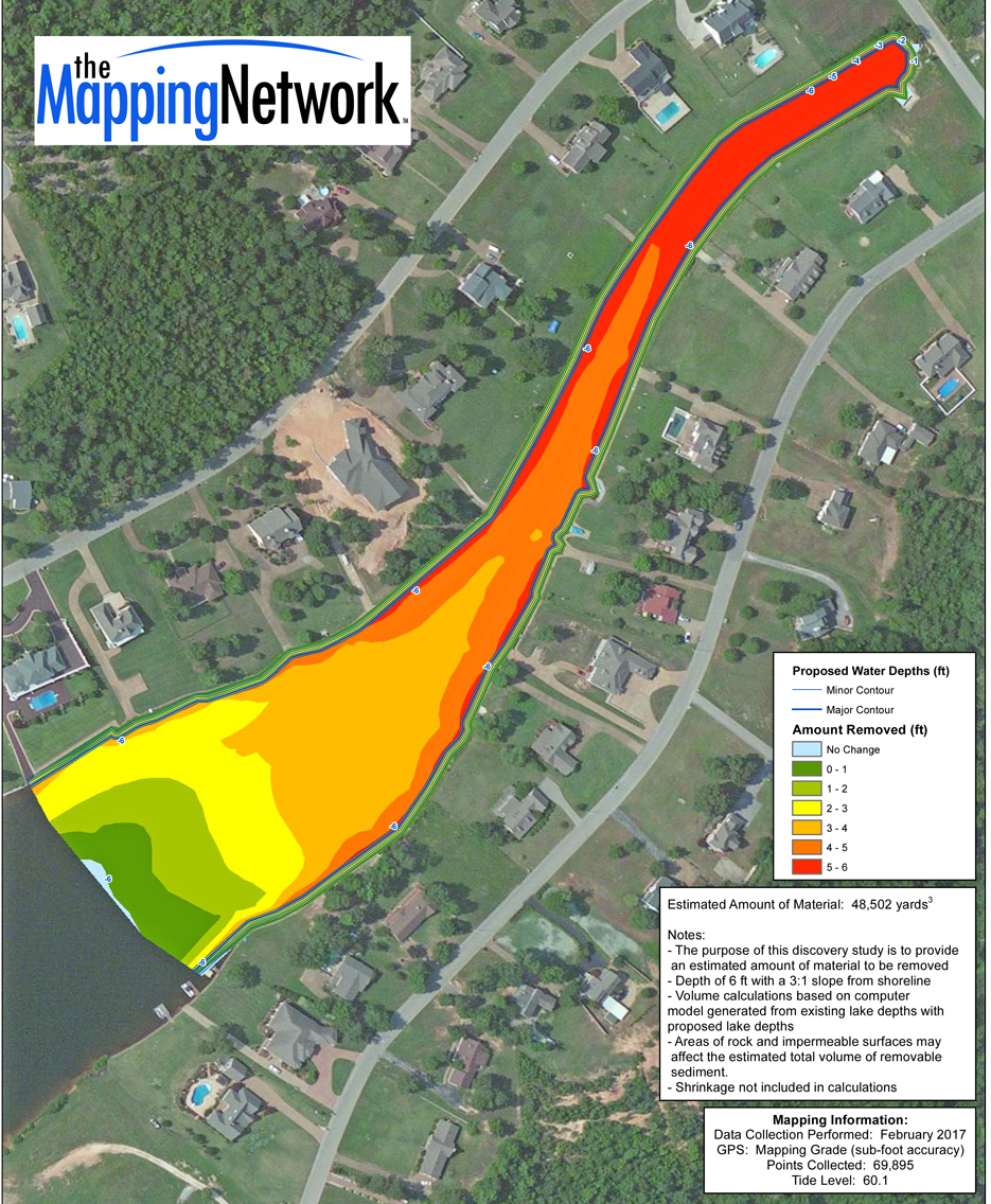
Dredge Excavation Planning in Lake Cove
The Mapping Network utilized several different technologies to create a 3D model of the land and water topography. The Mapping Network used a combination of Hypack, RTK GPS, and Odom CV100 Sonar to create the bathymetry map. For land topography The Mapping Network used RTK and UAV technology. This model was used to calculate the amount of sediment that needed to be removed so lake managers could plan the upcoming lake dredging project.
About The Mapping Network:
The Mapping Network is an industry leader in Geographic Information Systems, GPS Data Collection, Aerial Imagery, and Data Conversion. We specialize in terrain and sub-surface (bathymetry) GPS mapping, topographic mapping, and aerial imagery. Give us a call or send an e-mail to find out more details.
phone: (402) 241-8177
e-mail: info@themappingnetwork.com
website: www.themappingnetwork.com
Check out The Mapping Network on Twitter or Facebook for more examples and success stories!
![]()