
Hydrographic and Sediment Survey of Lake in Kansas City, MO
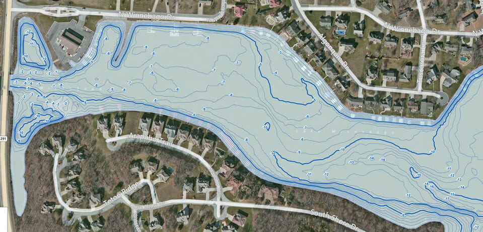
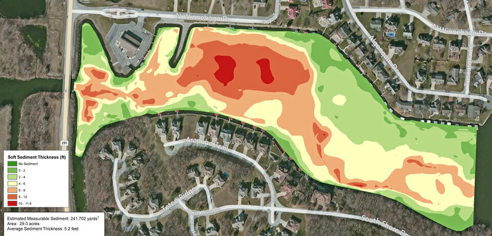
The Mapping Network created a hydrographic and sediment survey for a property owners association in a suburb of Kansas City, Missouri. The client was experiencing an increase in sediment on the main inflow and also 7 other coves. Residents were having difficulties accessing the main body of the lake from their docks due to shallow water. The POA needed to know how much sediment had accumulated in each cove to budget for removal in the near future. As a result of the lake survey the POA not only has an understanding of the amount of sediment in the coves, but they also have an accurate map of the entire lake. This map will be used by the property owners as a fishing map and as a baseline for future monitoring of sedimentation.
About The Mapping Network:
The Mapping Network is an industry leader in Geographic Information Systems Consulting, Data Conversion, and GPS Data Collection. We specialize in terrain and sub-surface (bathymetry) GPS mapping, and recreational Real Estate listings. The Mapping Network is proud to announce their firm has been chosen by Cabela’s, the World’s Foremost Outfitter, as a Landowner Services provider for Cabela’s Trophy Properties throughout the United States. Visit us on the Cabela’s Trophy Properties website >> click here Give us a call or send an e-mail to find out more details.
phone: (402) 241-8177
e-mail: info@themappingnetwork.com
website: www.themappingnetwork.com
Check out The Mapping Network on Facebook for more examples and success stories!
![]()