
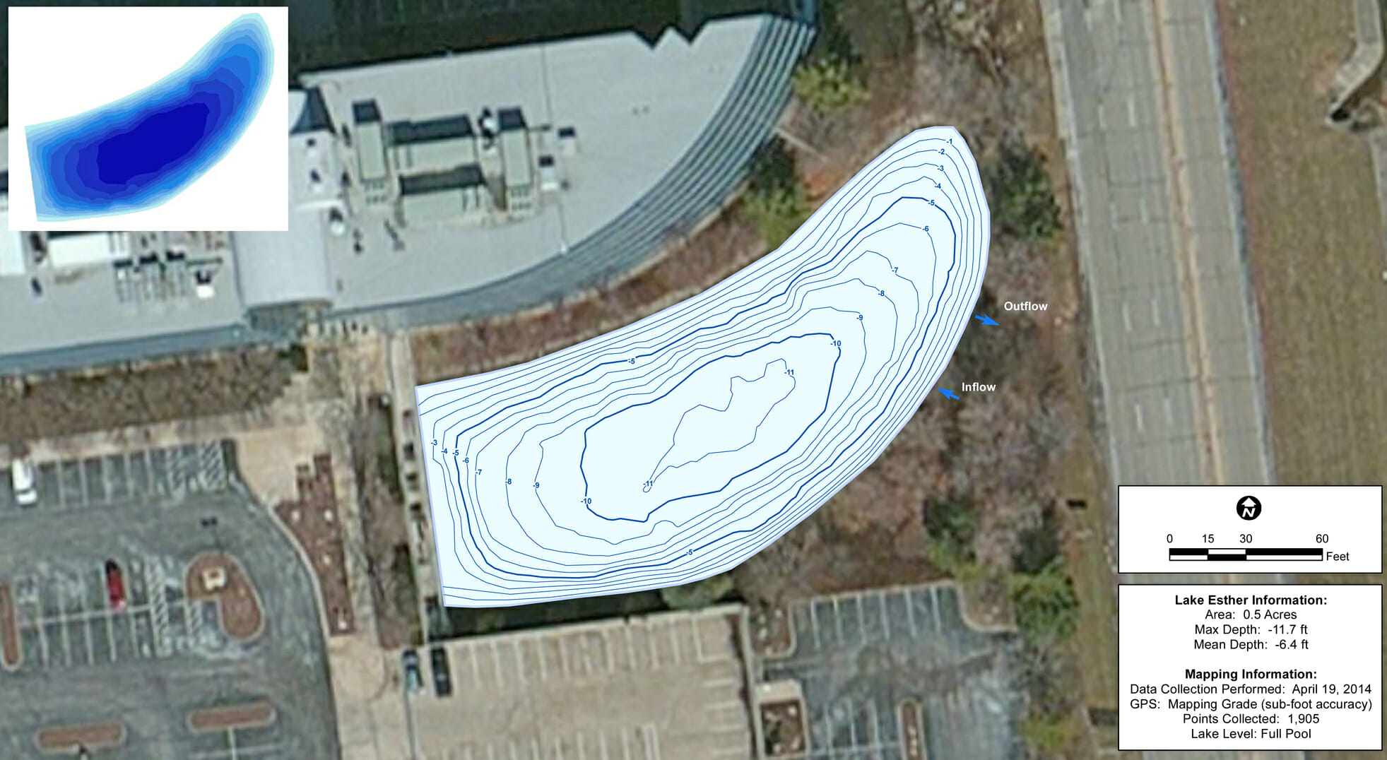
Lake Bathymetry Study of Pond in St. Louis, Missouri
The Mapping Network and Leisure Ponds teamed up to create a bathymetric study for a pond on a commercial property in St. Louis, Missouri. Up-to-date water depths and volume are required for treatment applications, fisheries management and monitoring sedimentation rates. Jim Darlington, owner of Leisure Ponds also generated a report on the health of the pond to ensure proper management and continued enjoyment for employees.
About The Mapping Network:
The Mapping Network is an industry leader in Geographic Information Systems Consulting, Data Conversion, and GPS Data Collection. We specialize in terrain and sub-surface (bathymetry) GPS mapping, and recreational Real Estate listings. The Mapping Network is proud to announce their firm has been chosen by Cabela’s, the World’s Foremost Outfitter, as a Landowner Services provider for Cabela’s Trophy Properties throughout the United States. Give us a call or send an e-mail to find out more details.
phone: (402) 241-8177
e-mail: info@themappingnetwork.com
website: www.themappingnetwork.com
Check out The Mapping Network on Facebook for more examples and success stories!
![]()