
Kansas City Lake and Sediment Survey
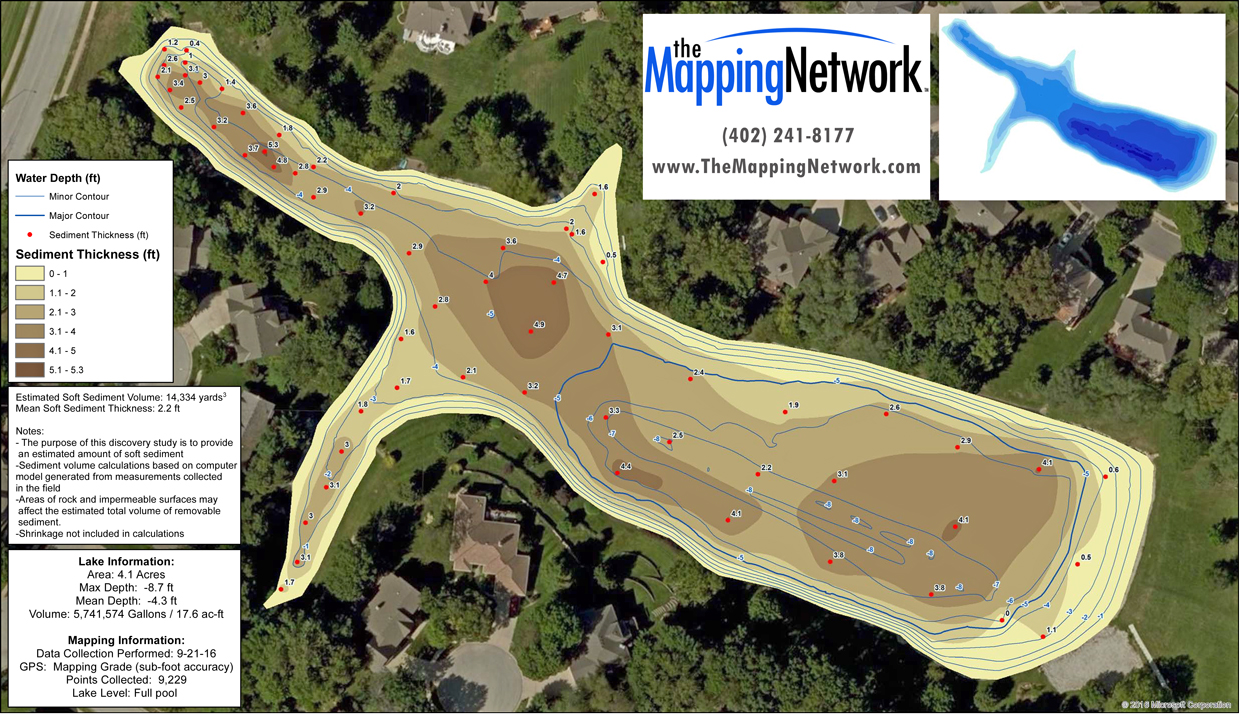
The Mapping Network completed a water depth and sediment thickness survey for a homeowners association in Kansas City, MO. The HOA needed to understand the amount and distribution of sediment currently in the lake so they could collect bids from dredge contractors.
About The Mapping Network:
The Mapping Network is an industry leader in Geographic Information Systems, GPS Data Collection, Aerial Imagery, and Data Conversion. We specialize in terrain and sub-surface (bathymetry) GPS mapping, topographic mapping, and aerial imagery. Give us a call or send an e-mail to find out more details.
phone: (402) 241-8177
e-mail: info@themappingnetwork.com
website: www.themappingnetwork.com
Check out The Mapping Network on Twitter or Facebook for more examples and success stories!