
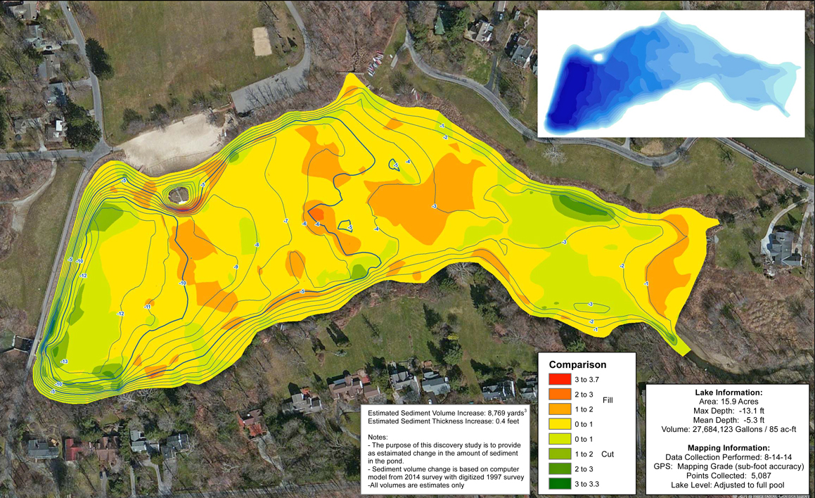
Lake Depth Comparison for Dredge Planning
A POA’s 16 acres lake in Cleveland, Ohio, has experienced changing lake levels in the past two decades. The POA Board hired The Mapping Network to map the current lake depths and compare the existing conditions with a survey from 1997. The resulting comparison map shows where sediment has accumulated over time. The POA now knows where a dredging contractor should focus effort to remove the sediment.
About The Mapping Network:
The Mapping Network is an industry leader in Geographic Information Systems, GPS Data Collection, Aerial Imagery, and Data Conversion. We specialize in terrain and sub-surface (bathymetry) GPS mapping, topographic mapping, and aerial imagery. Give us a call or send an e-mail to find out more details.
phone: (402) 241-8177
e-mail: info@themappingnetwork.com
website: www.themappingnetwork.com
Check out The Mapping Network on Twitter or Facebook for more examples and success stories!