
Power Station Predredge Survey for Ash Pond Dredging Project
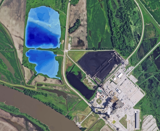
The Mapping Network team performed a hydrographic predredge survey on a large ash reservoir for a power station in Kansas. The purpose was to quantify and locate ash accumulation that needed to be dredged per EPA regulations. By comparing the original bottoms of the ponds with the current bottom depths, a computer model calculated the location and amount of material. The power company and dredge contractor will use this information to assist in validating that all the material has been removed.
About The Mapping Network:
The Mapping Network is an industry leader in Geographic Information Systems, GPS Data Collection, UAV Aerial Imagery, and Data Conversion. We specialize in terrain and sub-surface (bathymetry) GPS mapping, topographic mapping, and UAV aerial imagery. Give us a call or send an e-mail to find out more details.
phone: (402) 241-8177
e-mail: info@themappingnetwork.com
website: www.themappingnetwork.com
Check out The Mapping Network on Twitter or Facebook for more examples and success stories!