
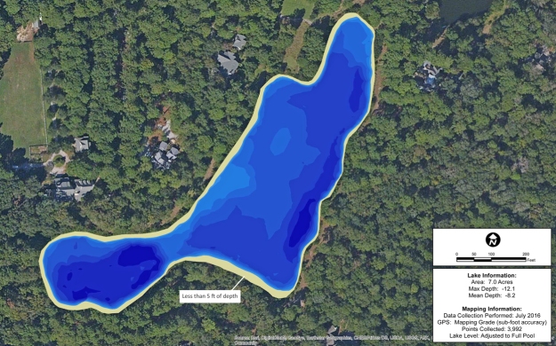
South Carolina Lake Mapping to Identify Spawning Habitat
Quality Lakes mapped a lake in rural South Carolina as part of a fisheries habitat plan. The client needed to locate potential spawning tables, which occur in 5 foot of water or less. Additional habitat work will ensue to allow for additional spawning areas to increase the overall health of the fishery.
About The Mapping Network:
The Mapping Network is an industry leader in Geographic Information Systems, GPS Data Collection, Aerial Imagery, and Data Conversion. We specialize in terrain and sub-surface (bathymetry) GPS mapping, topographic mapping, and aerial imagery. Give us a call or send an e-mail to find out more details.
phone: (402) 241-8177
e-mail: info@themappingnetwork.com
website: www.themappingnetwork.com
Check out The Mapping Network on Twitter or Facebook for more examples and success stories!