
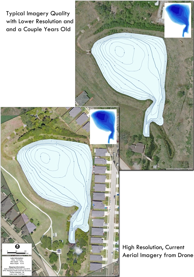
High Resolution Drone Aerials for Lake Mapping
Trent Lewis, owner of PondMedics, had a homeowners association with many homes constructed in the past couple years around their ponds. The HOA needed to determine the current water depths along with sediment volume. Since most aerial imagery services take a year or two (sometimes longer) to update, a majority of the newly constructed homes were not shown. PondMedics flew the property with a specialized drone and The Mapping Network assisted in processing the data to create a georeferenced orthomosaic. The result produced a highly accurate lake map with crisp, up-to-date imagery.
About The Mapping Network:
The Mapping Network is an industry leader in Geographic Information Systems, GPS Data Collection, Aerial Imagery, and Data Conversion. We specialize in terrain and sub-surface (bathymetry) GPS mapping, topographic mapping, and aerial imagery. Give us a call or send an e-mail to find out more details.
phone: (402) 241-8177
e-mail: info@themappingnetwork.com
website: www.themappingnetwork.com
Check out The Mapping Network on Twitter or Facebook for more examples and success stories!