
When Accuracy Matters, Choose The Mapping Network
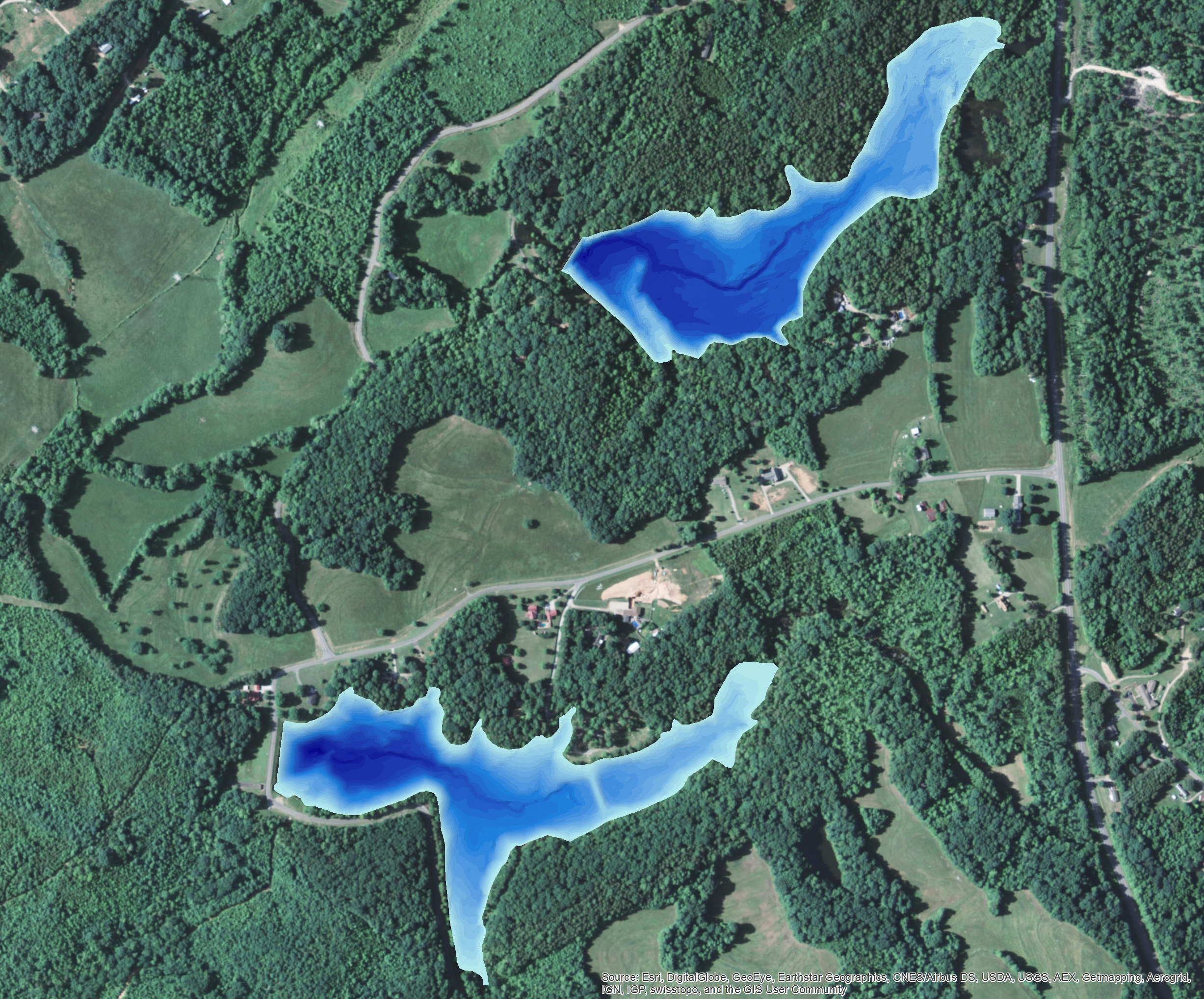
The Mapping Network utilized a combination of Hypack, RTK GPS, and Odom CV100 Sonar to create a highly accurate bathymetric map for a pair of lakes in Ohio. With precision lake mapping through The Mapping Network, many important features of the lake can be seen. On the map below, showing 3D shaded water depth, many definitive features can be seen including the original river channels in each lake and even an old road crossing the southern lake!
 About The Mapping Network:
The Mapping Network is an industry leader in Geographic Information Systems, GPS Data Collection, Aerial Imagery, and Data Conversion. We specialize in terrain and sub-surface (bathymetry) GPS mapping, topographic mapping, and aerial imagery. Give us a call or send an e-mail to find out more details.
phone: (402) 241-8177
e-mail: info@themappingnetwork.com
website: www.themappingnetwork.com
Check out The Mapping Network on Twitter or Facebook for more examples and success stories!
![]()