
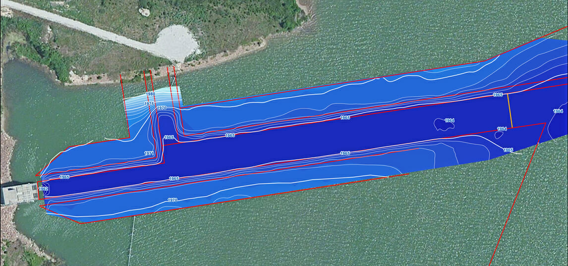
Power Plant Intake Dredge Project Hydrographic Survey
The Mapping Network has extensive experience performing hydrographic surveys on intake channels for power plants and drinking water intakes. On the example below The Mapping Network conducted a pre and post dredge survey along with calculating the amount of material removed. The map below is the post-dredge survey after all dredging operations were performed.
About The Mapping Network:
The Mapping Network is an industry leader in Geographic Information Systems, GPS Data Collection, Aerial Imagery, and Data Conversion. We specialize in terrain and sub-surface (bathymetry) GPS mapping, topographic mapping, and aerial imagery. Give us a call or send an e-mail to find out more details.
phone: (402) 241-8177
e-mail: info@themappingnetwork.com
website: www.themappingnetwork.com
Check out The Mapping Network on Twitter or Facebook for more examples and success stories.
![]()