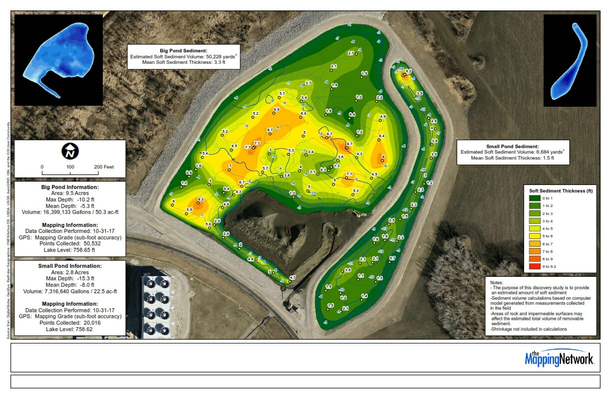
Coal Ash Pond Bathymetry and Dredge Survey
The Mapping Network performed a hydrographic and dredge survey for a power plant’s coal ash ponds. These can be difficult because of the composition of material. With the combination our sonar, GPS, and years of experience with coal ash, we were able to give them an accurate estimate of ash volume.