
Lake Volume Analysis Study
GPS Lake Mapping Accurately Accounts for Current Water Capacity
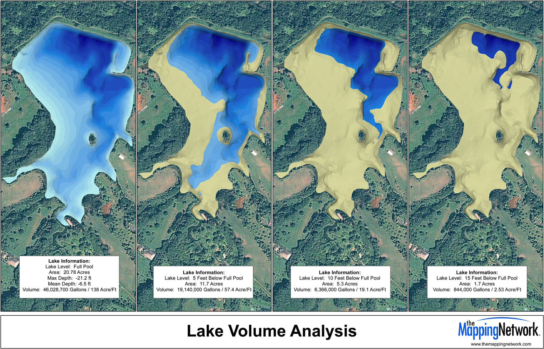
It is critical to know the exact acreage and depth range of your lake to make sound management decisions. Precision GPS lake mapping conducted by The Mapping Network utilizes highly accurate procedures and equipment for data collection. Utilizing sub-foot accurate GPS units and hydro-acoustic depth-sounding equipment, our team logs data points for extremely accurate location mapping. Our clients are able to accurately understand how much water is available in their lake at any number of water levels. Best of all, this information is up-to-date and can be customized to any requirement. Need to know how many gallons of water are available when the lake is at full pool? How about if the water level is down 5, 10, or 15 feet? We can even calculate the amount of water in certain depth ranges (example: volume for 5 to 6 feet). Current, accurate results are our specialty.
A GPS Bathymetric Lake Map and Volume Analysis Study by The Mapping Network will help optimize your efforts to manage your lake or pond.
Please contact us for more information on how this service can assist you in managing your aquatic resource.
About The Mapping Network:
The Mapping Network is an industry leader in Geographic Information Systems Consulting, Data Conversion, and GPS Data Collection. We specialize in terrain and sub-surface (bathymetry) GPS mapping, and recreational Real Estate listings. Give us a call or send an e-mail to find out more details.
phone: (402) 241-8177
e-mail: info@themappingnetwork.com
website: www.themappingnetwork.com
Check out The Mapping Network on Facebook for more examples and success stories!
![]()