
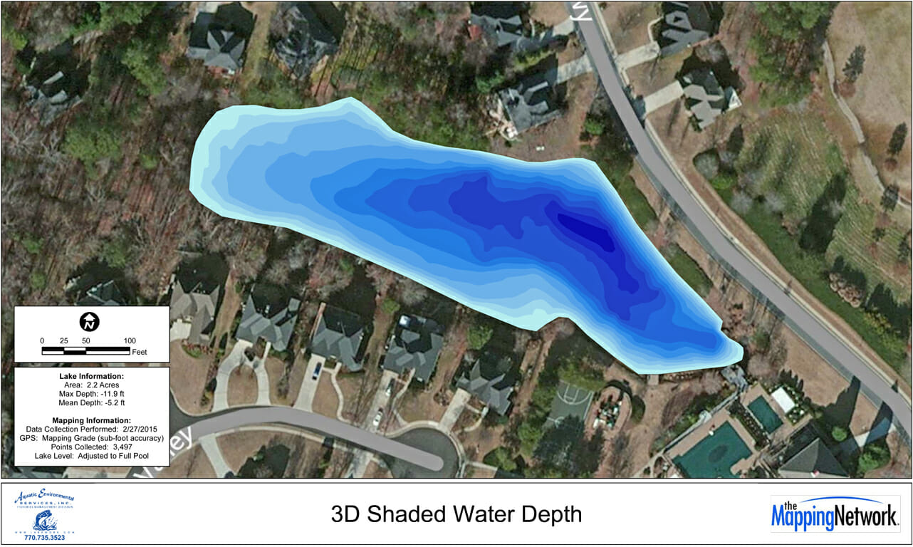
Pond Depth Mapping in Atlanta, Georgia
The Mapping Network and Aquatic Environmental Services teamed up to create a bathymetric study for a pond in a golf course community in Atlanta, Georgia. Up-to-date water depths and volume are required for treatment applications, fisheries management and monitoring sedimentation rates.
About The Mapping Network:
The Mapping Network is an industry leader in Geographic Information Systems, GPS Data Collection, Aerial Imagery, and Data Conversion. We specialize in terrain and sub-surface (bathymetry) GPS mapping, topographic mapping, and aerial imagery. Give us a call or send an e-mail to find out more details.
phone: (402) 241-8177
e-mail: info@themappingnetwork.com
website: www.themappingnetwork.com
Check out The Mapping Network on Twitter or Facebook for more examples and success stories!
![]()